
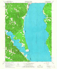
~ Widewater VA topo map, 1:24000 scale, 7.5 X 7.5 Minute, Historical, 1966, updated 1968
Widewater, Virginia, USGS topographic map dated 1966.
Includes geographic coordinates (latitude and longitude). This topographic map is suitable for hiking, camping, and exploring, or framing it as a wall map.
Printed on-demand using high resolution imagery, on heavy weight and acid free paper, or alternatively on a variety of synthetic materials.
Topos available on paper, Waterproof, Poly, or Tyvek. Usually shipping rolled, unless combined with other folded maps in one order.
- Product Number: USGS-5301952
- Free digital map download (high-resolution, GeoPDF): Widewater, Virginia (file size: 12 MB)
- Map Size: please refer to the dimensions of the GeoPDF map above
- Weight (paper map): ca. 55 grams
- Map Type: POD USGS Topographic Map
- Map Series: HTMC
- Map Verison: Historical
- Cell ID: 48962
- Scan ID: 187214
- Imprint Year: 1968
- Woodland Tint: Yes
- Aerial Photo Year: 1963
- Field Check Year: 1966
- Datum: NAD27
- Map Projection: Polyconic
- Map published by United States Geological Survey
- Map Language: English
- Scanner Resolution: 600 dpi
- Map Cell Name: Widewater
- Grid size: 7.5 X 7.5 Minute
- Date on map: 1966
- Map Scale: 1:24000
- Geographical region: Virginia, United States
Neighboring Maps:
All neighboring USGS topo maps are available for sale online at a variety of scales.
Spatial coverage:
Topo map Widewater, Virginia, covers the geographical area associated the following places:
- Stonebridge at Widewater - Fritters Corner - Green Manor Estates - Widewater - Aqua Villa - Raspberry - Colonial Port - Freedom Estates - Norman Estates - Jessica Estates - Widewater Estates - Aquia Beach - Poplar Hills - Midway Island - Freds Corner - Loy Landing - Sunshine View - Uly Brooks - Liverpool Wharf - Aquia Bend - Northern View Estates - Quarry Estates - Canterbury Estates - Sunshine Hills - Brooksmill Estates - Widewater Beach - Saratoga - Arkendale - Estates of Widewater Pond - Midway Estates - Rivendell - Sams Ridge - Decatur (historical) - Thorny Point Farm - Brooke Ridge - Aquia Inlet Estates - Aquia Bay Estates - Aquia Overlook - Harris - Sunshine Acres - Bayview Estates - Chelsea Estates - Windermere
- Map Area ID: AREA38.538.375-77.375-77.25
- Northwest corner Lat/Long code: USGSNW38.5-77.375
- Northeast corner Lat/Long code: USGSNE38.5-77.25
- Southwest corner Lat/Long code: USGSSW38.375-77.375
- Southeast corner Lat/Long code: USGSSE38.375-77.25
- Northern map edge Latitude: 38.5
- Southern map edge Latitude: 38.375
- Western map edge Longitude: -77.375
- Eastern map edge Longitude: -77.25


