
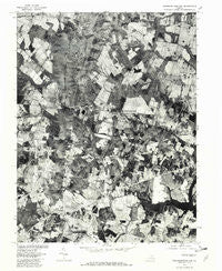
~ Thoroughfare Gap VA topo map, 1:24000 scale, 7.5 X 7.5 Minute, Historical, 1977, updated 1982
Thoroughfare Gap, Virginia, USGS topographic map dated 1977.
Includes geographic coordinates (latitude and longitude). This topographic map is suitable for hiking, camping, and exploring, or framing it as a wall map.
Printed on-demand using high resolution imagery, on heavy weight and acid free paper, or alternatively on a variety of synthetic materials.
Topos available on paper, Waterproof, Poly, or Tyvek. Usually shipping rolled, unless combined with other folded maps in one order.
- Product Number: USGS-5301512
- Free digital map download (high-resolution, GeoPDF): Thoroughfare Gap, Virginia (file size: 21 MB)
- Map Size: please refer to the dimensions of the GeoPDF map above
- Weight (paper map): ca. 55 grams
- Map Type: POD USGS Topographic Map
- Map Series: HTMC
- Map Verison: Historical
- Cell ID: 44967
- Scan ID: 186958
- Imprint Year: 1982
- Aerial Photo Year: 1977
- Datum: NAD27
- Map Projection: Lambert Conformal Conic
- Orthophoto: Quad
- Map published by United States Geological Survey
- Keywords: Nonstandard Press Run
- Map Language: English
- Scanner Resolution: 600 dpi
- Map Cell Name: Thoroughfare Gap
- Grid size: 7.5 X 7.5 Minute
- Date on map: 1977
- Map Scale: 1:24000
- Geographical region: Virginia, United States
Neighboring Maps:
All neighboring USGS topo maps are available for sale online at a variety of scales.
Spatial coverage:
Topo map Thoroughfare Gap, Virginia, covers the geographical area associated the following places:
- Crescent - Woolsey - Knollwood Estates - Buckland - Beverley Mill - Kennard Ridge - Pilgrims Rest - Waterfall - Broken Hill - Hopewell - Burke Meadows - Mountain View Estates - Little Georgetown - Antioch - New Baltimore - Broad Run - Waterfall Village - Haymarket
- Map Area ID: AREA38.87538.75-77.75-77.625
- Northwest corner Lat/Long code: USGSNW38.875-77.75
- Northeast corner Lat/Long code: USGSNE38.875-77.625
- Southwest corner Lat/Long code: USGSSW38.75-77.75
- Southeast corner Lat/Long code: USGSSE38.75-77.625
- Northern map edge Latitude: 38.875
- Southern map edge Latitude: 38.75
- Western map edge Longitude: -77.75
- Eastern map edge Longitude: -77.625


