
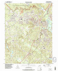
~ Stafford VA topo map, 1:24000 scale, 7.5 X 7.5 Minute, Historical, 1994, updated 1997
Stafford, Virginia, USGS topographic map dated 1994.
Includes geographic coordinates (latitude and longitude). This topographic map is suitable for hiking, camping, and exploring, or framing it as a wall map.
Printed on-demand using high resolution imagery, on heavy weight and acid free paper, or alternatively on a variety of synthetic materials.
Topos available on paper, Waterproof, Poly, or Tyvek. Usually shipping rolled, unless combined with other folded maps in one order.
- Product Number: USGS-5301212
- Free digital map download (high-resolution, GeoPDF): Stafford, Virginia (file size: 15 MB)
- Map Size: please refer to the dimensions of the GeoPDF map above
- Weight (paper map): ca. 55 grams
- Map Type: POD USGS Topographic Map
- Map Series: HTMC
- Map Verison: Historical
- Cell ID: 42813
- Scan ID: 186775
- Imprint Year: 1997
- Woodland Tint: Yes
- Aerial Photo Year: 1994
- Datum: NAD83
- Map Projection: Universal Transverse Mercator
- Map published by United States Geological Survey
- Map Language: English
- Scanner Resolution: 600 dpi
- Map Cell Name: Stafford
- Grid size: 7.5 X 7.5 Minute
- Date on map: 1994
- Map Scale: 1:24000
- Geographical region: Virginia, United States
Neighboring Maps:
All neighboring USGS topo maps are available for sale online at a variety of scales.
Spatial coverage:
Topo map Stafford, Virginia, covers the geographical area associated the following places:
- Park Ridge - Onville (historical) - Smith Lake Overlook - Bald Eagle Hills - Sky Terrace - Staffordborough - Garrisonville Estates - Brentwood Estates - Azalea Woods - Shenandoah - Saint Georges - Raintree - Glenwood Forest - Spring Lake Farm - Meadowood Park - Woodleigh - J A Macgregor Estate - Garrisonville - Stonefield - The Falls - Foreston Woods North - Hallbrooke Woods - Perry Farms - Quail Run - Coal Landing - Cobblestone - Eastern View - Tamarlane - Rolling Meadows - Colonial Terrace - Stone River - Cherry Hill Estates - Cabin Creekwood - Meadowlark - Somerset Landing - Woods of Able Lake - Aquia - Lake Ridge and Bethany Pointe - Cresent Pointe - Highpointe - Oakridge Pointe - Bells Run - Ramoth - Vista Woods - Saint Georges Estates - Serena Forest - Patriots Landing - Vintage Oaks - Shadow Woods - Rollinswood South - Brafferton - Austin Ridge - Beverly Forest - Meadowbrook Estates - Stallings - Stafford - King James Village - Magnolia Woods - Grays Steven Tract - Autumn Ridge - Fritters Lane - Widewater Village at Stafford - Sheltons Run - Estates of Brooke - Augustine North - Townes of Ashleigh - Stafford Heights - Locklears Landing - Kings Crest - Port Aquia - Country Ridge - Woodmont - Hollymead - Stowe of Amyclae - Courts at Stafford - Peacock Station - Whitson Ridge - Old Homestead - Apple Grove - Oakbrooke - Stafford Oaks - Manors at Greenridge - Oakridge Overlook - Hampton Oaks - Locklears Knoll - Heritage Oaks - Smith Lake Landing - Youngstead - Settlers Landing - Stefin Woods Estate - Subdivision Estates - Georgetown East - Will Morgan Farm - Shawnee Forest - Beau Ridge - Smith Lake Estates - Groves Estates - Barrett Knolls - Sunnyside - Devon Green
- Map Area ID: AREA38.538.375-77.5-77.375
- Northwest corner Lat/Long code: USGSNW38.5-77.5
- Northeast corner Lat/Long code: USGSNE38.5-77.375
- Southwest corner Lat/Long code: USGSSW38.375-77.5
- Southeast corner Lat/Long code: USGSSE38.375-77.375
- Northern map edge Latitude: 38.5
- Southern map edge Latitude: 38.375
- Western map edge Longitude: -77.5
- Eastern map edge Longitude: -77.375


