
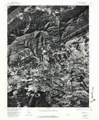
~ Salem VA topo map, 1:24000 scale, 7.5 X 7.5 Minute, Historical, 1977, updated 1983
Salem, Virginia, USGS topographic map dated 1977.
Includes geographic coordinates (latitude and longitude). This topographic map is suitable for hiking, camping, and exploring, or framing it as a wall map.
Printed on-demand using high resolution imagery, on heavy weight and acid free paper, or alternatively on a variety of synthetic materials.
Topos available on paper, Waterproof, Poly, or Tyvek. Usually shipping rolled, unless combined with other folded maps in one order.
- Product Number: USGS-5300904
- Free digital map download (high-resolution, GeoPDF): Salem, Virginia (file size: 21 MB)
- Map Size: please refer to the dimensions of the GeoPDF map above
- Weight (paper map): ca. 55 grams
- Map Type: POD USGS Topographic Map
- Map Series: HTMC
- Map Verison: Historical
- Cell ID: 39424
- Scan ID: 186608
- Imprint Year: 1983
- Aerial Photo Year: 1977
- Datum: NAD27
- Map Projection: Lambert Conformal Conic
- Orthophoto: Quad
- Map published by United States Geological Survey
- Keywords: Nonstandard Press Run
- Map Language: English
- Scanner Resolution: 600 dpi
- Map Cell Name: Salem
- Grid size: 7.5 X 7.5 Minute
- Date on map: 1977
- Map Scale: 1:24000
- Geographical region: Virginia, United States
Neighboring Maps:
All neighboring USGS topo maps are available for sale online at a variety of scales.
Spatial coverage:
Topo map Salem, Virginia, covers the geographical area associated the following places:
- Monte Vista - Crestmoor Court - Buckingham Estates - Montclair Estates - Fairfield - Barranger - Whitefield - Shamrock - Belle Aire - Woodside Park - Woodlawn - Spruce Hill - Karen Hills - Deep Dell - Wilmont Park - Dixie Heights - Windsor Court - Dropmore - Meadow Wood Estates - Roland Terrace - Dale Court - Oak Ridge - Hillview Park - Stratford Park - Cliffview - Cameron Court - Fairway Forest - Blue Ridge Park - West View Terrace - Crestmoor - Lewis Place - Moomaw Heights - Green Hill - Hanging Rock - Spangler - Oak Park - Westfield - Mountain View - Alta View - Edgelawn - Summit Hills - Fort Lewis Terrace - Cherry Hill Park - Edgewood - Windsor Hills - Conehurst - Bellevue Park - Salem Village Trailer Park - Forest Lawn - Park Place - Braxton Heights - Ridgewood Park - Beverly Heights North - Westland - West Chester - Washington Heights - Lake Spring Land - Orchard Heights - Salem - Palmer - Wedgewood Forest - Ridgewood Farm - Lawndale Heights - Braeburn - Hillcrest Heights - Circle Terrace - Burwell - Rolling Hills - Ridgewood Heights - Stonewall Forest - Mountain Heights East - Green Hill Terrace - Dawnwood Forest - Homeplace - West View - Southside Hills - Grandview - Lake View - Norwood - Beacon Hills - Manchester Court - South Edgewood - Willow Green - Mountain Heights - Country Club Estates - Glen Cove - Quail Crossing - Hockman - Middleton Gardens - Knollwood - Loch Haven - Locust Grove Park - Mason Cove - Riverland Court - Pine Grove - Westchester Court - Wiley Court - Plainview - Meadowview - Boulevard Estates
- Map Area ID: AREA37.37537.25-80.125-80
- Northwest corner Lat/Long code: USGSNW37.375-80.125
- Northeast corner Lat/Long code: USGSNE37.375-80
- Southwest corner Lat/Long code: USGSSW37.25-80.125
- Southeast corner Lat/Long code: USGSSE37.25-80
- Northern map edge Latitude: 37.375
- Southern map edge Latitude: 37.25
- Western map edge Longitude: -80.125
- Eastern map edge Longitude: -80


