
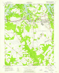
~ Princess Anne VA topo map, 1:24000 scale, 7.5 X 7.5 Minute, Historical, 1955, updated 1958
Princess Anne, Virginia, USGS topographic map dated 1955.
Includes geographic coordinates (latitude and longitude). This topographic map is suitable for hiking, camping, and exploring, or framing it as a wall map.
Printed on-demand using high resolution imagery, on heavy weight and acid free paper, or alternatively on a variety of synthetic materials.
Topos available on paper, Waterproof, Poly, or Tyvek. Usually shipping rolled, unless combined with other folded maps in one order.
- Product Number: USGS-5300478
- Free digital map download (high-resolution, GeoPDF): Princess Anne, Virginia (file size: 7 MB)
- Map Size: please refer to the dimensions of the GeoPDF map above
- Weight (paper map): ca. 55 grams
- Map Type: POD USGS Topographic Map
- Map Series: HTMC
- Map Verison: Historical
- Cell ID: 36458
- Scan ID: 186360
- Imprint Year: 1958
- Woodland Tint: Yes
- Aerial Photo Year: 1952
- Field Check Year: 1955
- Survey Year: 1944
- Datum: NAD27
- Map Projection: Polyconic
- Map published by United States Army Corps of Engineers
- Map Language: English
- Scanner Resolution: 600 dpi
- Map Cell Name: Princess Anne
- Grid size: 7.5 X 7.5 Minute
- Date on map: 1955
- Map Scale: 1:24000
- Geographical region: Virginia, United States
Neighboring Maps:
All neighboring USGS topo maps are available for sale online at a variety of scales.
Spatial coverage:
Topo map Princess Anne, Virginia, covers the geographical area associated the following places:
- Ocean Pines Mobile Home Park - Salem - Gunn Hall Manor - Rosemont - Chesopeian Colony - Pinewood Gardens - Powells Corner - Gatewood Park - Hills Corner - Landtown - Little Haven - Eureka Park - Eastern Park - Point O'Woods - Southern Points - Atlantic Park - Colony Acres - Princess Anne - Linkhorn - Woodhouse Corner - Magic Hollow - Tapo Mobile Park - Cardinal Estates - Pecan Gardens - Linkhorn Estates - Laurel Manor - Mapleton - Windsor Woods - Thalia Gardens - Thalia Village - Wolfsnare Plantation - Birchwood-Gardens - Murdens Corner - Shipps Corner - Trantwood Shores - Oceana - Thalia Manor - Lynnwood - Thalia Shores - The Lakes - Kings Arm - Robinhood Forest - Malibu - Michaelwood - Green Run - Macons Corner - Princess Anne Plaza - Thalia - Linlier - Lamplight Manor - Lynnhaven - Lynnhaven Acres - London Bridge - Nimmo - Lynn Shores - Derby Run Mobile Home Park - Kings Grant
- Map Area ID: AREA36.87536.75-76.125-76
- Northwest corner Lat/Long code: USGSNW36.875-76.125
- Northeast corner Lat/Long code: USGSNE36.875-76
- Southwest corner Lat/Long code: USGSSW36.75-76.125
- Southeast corner Lat/Long code: USGSSE36.75-76
- Northern map edge Latitude: 36.875
- Southern map edge Latitude: 36.75
- Western map edge Longitude: -76.125
- Eastern map edge Longitude: -76


