
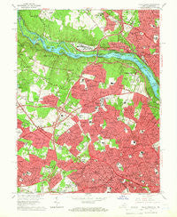
~ Falls Church VA topo map, 1:24000 scale, 7.5 X 7.5 Minute, Historical, 1965, updated 1966
Falls Church, Virginia, USGS topographic map dated 1965.
Includes geographic coordinates (latitude and longitude). This topographic map is suitable for hiking, camping, and exploring, or framing it as a wall map.
Printed on-demand using high resolution imagery, on heavy weight and acid free paper, or alternatively on a variety of synthetic materials.
Topos available on paper, Waterproof, Poly, or Tyvek. Usually shipping rolled, unless combined with other folded maps in one order.
- Product Number: USGS-5298002
- Free digital map download (high-resolution, GeoPDF): Falls Church, Virginia (file size: 14 MB)
- Map Size: please refer to the dimensions of the GeoPDF map above
- Weight (paper map): ca. 55 grams
- Map Type: POD USGS Topographic Map
- Map Series: HTMC
- Map Verison: Historical
- Cell ID: 14949
- Scan ID: 184947
- Imprint Year: 1966
- Woodland Tint: Yes
- Aerial Photo Year: 1955
- Edit Year: 1965
- Field Check Year: 1956
- Datum: NAD27
- Map Projection: Polyconic
- Map published by United States Geological Survey
- Map Language: English
- Scanner Resolution: 600 dpi
- Map Cell Name: Falls Church
- Grid size: 7.5 X 7.5 Minute
- Date on map: 1965
- Map Scale: 1:24000
- Geographical region: Virginia, United States
Neighboring Maps:
All neighboring USGS topo maps are available for sale online at a variety of scales.
Spatial coverage:
Topo map Falls Church, Virginia, covers the geographical area associated the following places:
- Halls Hill - The Cloisters - Belleview - Greenway Downs - Woodhaven - Dunn Loring Woods - Mohican Hills - Tyler Gardens - Offutt Village - Odricks Corner - Tysons - Oakwood - Oakwood Knolls - Langley - Carderock Springs - Brockwood - Country Club Grove - Williamsburg Village - Franklin Forest - Old Courthouse - Hillmead - Crescent Hills - West Arlington - Dunn Loring - Cabin John Park - Balls Hill - Kent Gardens - Falls Hill - Tysons Green - Chesterbrook Estates - Swinks Mill - Berkshire - Glen Echo - Enola - Allencrest - Ash Grove - Millburn Terrace - West McLean - Olney Park - Dominion Hills - McLean Hamlet - El Nido - Brookhaven - Falls Church - Cabin John - Tulip Hill - Lacey Forest - Glenmere - Bannockburn Estates - Southridge - West Langley - Southampton Forest - Lewinsville Heights - Ingleside - Poplar Heights - Congressional Manor - Woodburn - Virginia Forest - Churchill - Elmwood Estates - Rosemont - Langley Forest - Lewinsville - Stratford Hills - Pimmit Hills - Old Dominion Gardens - Bannockburn Heights - Clearview Manor - Chesterbrook Gardens - Antrim - Cropley - Westover - Garden City - Westwood Park - Brockmont - Potomac Hills - Madison Manor - Broyhill-Langley Estates - Brilyn Park - Donna Lee Gardens - Franklin - River Oaks - Stonewall Manor - Evermay - East Falls Church - Walker Chapel - Langley Oaks - Broyhill-Glen Gary Park - Salona Village - Merrimack Park - Bryn Mawr - Foxhall - Madrillon Farms - Glendale - Cohasset - Tara - Fawsett Farms - Hillwood - Bannockburn - West Falls Church
- Map Area ID: AREA3938.875-77.25-77.125
- Northwest corner Lat/Long code: USGSNW39-77.25
- Northeast corner Lat/Long code: USGSNE39-77.125
- Southwest corner Lat/Long code: USGSSW38.875-77.25
- Southeast corner Lat/Long code: USGSSE38.875-77.125
- Northern map edge Latitude: 39
- Southern map edge Latitude: 38.875
- Western map edge Longitude: -77.25
- Eastern map edge Longitude: -77.125


