
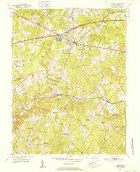
~ Fairfax VA topo map, 1:24000 scale, 7.5 X 7.5 Minute, Historical, 1951, updated 1952
Fairfax, Virginia, USGS topographic map dated 1951.
Includes geographic coordinates (latitude and longitude). This topographic map is suitable for hiking, camping, and exploring, or framing it as a wall map.
Printed on-demand using high resolution imagery, on heavy weight and acid free paper, or alternatively on a variety of synthetic materials.
Topos available on paper, Waterproof, Poly, or Tyvek. Usually shipping rolled, unless combined with other folded maps in one order.
- Product Number: USGS-5297964
- Free digital map download (high-resolution, GeoPDF): Fairfax, Virginia (file size: 13 MB)
- Map Size: please refer to the dimensions of the GeoPDF map above
- Weight (paper map): ca. 55 grams
- Map Type: POD USGS Topographic Map
- Map Series: HTMC
- Map Verison: Historical
- Cell ID: 70039
- Scan ID: 184920
- Imprint Year: 1952
- Woodland Tint: Yes
- Aerial Photo Year: 1949
- Field Check Year: 1951
- Datum: NAD27
- Map Projection: Polyconic
- Map published by United States Geological Survey
- Map Language: English
- Scanner Resolution: 600 dpi
- Map Cell Name: Fairfax
- Grid size: 7.5 X 7.5 Minute
- Date on map: 1951
- Map Scale: 1:24000
- Geographical region: Virginia, United States
Neighboring Maps:
All neighboring USGS topo maps are available for sale online at a variety of scales.
Spatial coverage:
Topo map Fairfax, Virginia, covers the geographical area associated the following places:
- Fairwood Acres - Kiels Gardens - Penderlan - Pohick Park - Greenway Hills - Country Club Hills - Mantua - Glen Alden - Holly Park - Rutherford - Blevinstown - Keene Mill Heights - Fairfax Woods - Fairfax - Doveville - Fairfax Farms - Halemhurst - Vannoy Acres - Hunts Village - Penderbrook - Burke - Cobbdale - Boulevard Estates - Warren Woods - Maple Hills - Mosby Woods - Waples Mill - Red Fox Forest - Fairfax Forest - Fair Oaks - Little Run Estates - Lee-Hi Village - Avon Forest - Donovans Corner - Lee Forest - Lord Fairfax Estates - Fairchester - Fairfax Acres - Blue Oaks - Colchester Acres - Lee Meadows - Makleys Corner - Five Forks - Shirley Gate Park - Elgin Corner - Fairlee - Little River Hills - Green Acres - Ardmore - Legato - Fair Oaks - Station Hills - Robeys Mill - Sideburn - Fairfax Station - Belleair - Ilda - Country Club View - Butts Corner - Fairview - Jermantown - Willow Woods - Random Hills - Joyce Heights - Lincoln Park - Holly Park Estates - Woods of Ilda - Mantua Hills - Pender - Dixie Hill
- Map Area ID: AREA38.87538.75-77.375-77.25
- Northwest corner Lat/Long code: USGSNW38.875-77.375
- Northeast corner Lat/Long code: USGSNE38.875-77.25
- Southwest corner Lat/Long code: USGSSW38.75-77.375
- Southeast corner Lat/Long code: USGSSE38.75-77.25
- Northern map edge Latitude: 38.875
- Southern map edge Latitude: 38.75
- Western map edge Longitude: -77.375
- Eastern map edge Longitude: -77.25


