
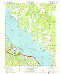
~ Clay Bank VA topo map, 1:24000 scale, 7.5 X 7.5 Minute, Historical, 1965, updated 1973
Clay Bank, Virginia, USGS topographic map dated 1965.
Includes geographic coordinates (latitude and longitude). This topographic map is suitable for hiking, camping, and exploring, or framing it as a wall map.
Printed on-demand using high resolution imagery, on heavy weight and acid free paper, or alternatively on a variety of synthetic materials.
Topos available on paper, Waterproof, Poly, or Tyvek. Usually shipping rolled, unless combined with other folded maps in one order.
- Product Number: USGS-5297336
- Free digital map download (high-resolution, GeoPDF): Clay Bank, Virginia (file size: 12 MB)
- Map Size: please refer to the dimensions of the GeoPDF map above
- Weight (paper map): ca. 55 grams
- Map Type: POD USGS Topographic Map
- Map Series: HTMC
- Map Verison: Historical
- Cell ID: 8985
- Scan ID: 184564
- Imprint Year: 1973
- Woodland Tint: Yes
- Photo Revision Year: 1972
- Aerial Photo Year: 1972
- Field Check Year: 1965
- Datum: NAD27
- Map Projection: Polyconic
- Map published by United States Geological Survey
- Map Language: English
- Scanner Resolution: 600 dpi
- Map Cell Name: Clay Bank
- Grid size: 7.5 X 7.5 Minute
- Date on map: 1965
- Map Scale: 1:24000
- Geographical region: Virginia, United States
Neighboring Maps:
All neighboring USGS topo maps are available for sale online at a variety of scales.
Spatial coverage:
Topo map Clay Bank, Virginia, covers the geographical area associated the following places:
- Hermitage - Clay Bank Acres - Rosewell Harbor - Olivers Estates - Wicomico Mobile Village - Concord (historical) - Rosewell - Carters Cove - Concord - Creekwood Cove Estates - Gum Fork - Millwood - White Marsh - Cheatham Annex - Charles Corner - Oakdale - Wicomico - Clay Bank - Hermitage Banks - Clopton - Clopton Heights - Harbor Hills - Robert Heights - Powhatan Shores - Country Village - Hayes - Ordinary - Carp Circle - R and L Mobile Home Park - Shilsons Corner - York River Pines - York View - Roanes - Neva Terrace
- Map Area ID: AREA37.37537.25-76.625-76.5
- Northwest corner Lat/Long code: USGSNW37.375-76.625
- Northeast corner Lat/Long code: USGSNE37.375-76.5
- Southwest corner Lat/Long code: USGSSW37.25-76.625
- Southeast corner Lat/Long code: USGSSE37.25-76.5
- Northern map edge Latitude: 37.375
- Southern map edge Latitude: 37.25
- Western map edge Longitude: -76.625
- Eastern map edge Longitude: -76.5


