
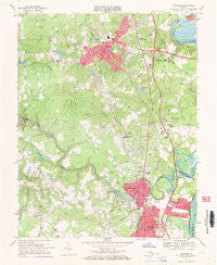
~ Chester VA topo map, 1:24000 scale, 7.5 X 7.5 Minute, Historical, 1969, updated 1971
Chester, Virginia, USGS topographic map dated 1969.
Includes geographic coordinates (latitude and longitude). This topographic map is suitable for hiking, camping, and exploring, or framing it as a wall map.
Printed on-demand using high resolution imagery, on heavy weight and acid free paper, or alternatively on a variety of synthetic materials.
Topos available on paper, Waterproof, Poly, or Tyvek. Usually shipping rolled, unless combined with other folded maps in one order.
- Product Number: USGS-5297202
- Free digital map download (high-resolution, GeoPDF): Chester, Virginia (file size: 11 MB)
- Map Size: please refer to the dimensions of the GeoPDF map above
- Weight (paper map): ca. 55 grams
- Map Type: POD USGS Topographic Map
- Map Series: HTMC
- Map Verison: Historical
- Cell ID: 8410
- Scan ID: 184473
- Imprint Year: 1971
- Woodland Tint: Yes
- Aerial Photo Year: 1968
- Field Check Year: 1969
- Survey Year: 1941
- Datum: NAD27
- Map Projection: Polyconic
- Map published by United States Geological Survey
- Map Language: English
- Scanner Resolution: 600 dpi
- Map Cell Name: Chester
- Grid size: 7.5 X 7.5 Minute
- Date on map: 1969
- Map Scale: 1:24000
- Geographical region: Virginia, United States
Neighboring Maps:
All neighboring USGS topo maps are available for sale online at a variety of scales.
Spatial coverage:
Topo map Chester, Virginia, covers the geographical area associated the following places:
- Greenleigh Mobile Home Park - Preston Place - Gay Farms - Walthall - Braebrook Village - Lakewood Estates - Glebe Point - Bermuda Place - Pineland - Dunlop - Lakeview - Stafford Place - Victoria Hills - Sherwood Hills - Lora Lynn Heights - Locust Grove - Chesterbrook Farms - Windsor Hills - Chester - Carver Homes - Greenbriar - Boulevard Heights - Grove Place - Columbia Park - Woodlawn - Mistwood Forest - Archer Bluff - Somerset - Hidden Valley Estates - Edenshire - Dutch Gap - Shadowbrook Heights - Pickadat Corner - Autumn Oaks - Bryan Ridge - Tinsberry Trace
- Map Area ID: AREA37.37537.25-77.5-77.375
- Northwest corner Lat/Long code: USGSNW37.375-77.5
- Northeast corner Lat/Long code: USGSNE37.375-77.375
- Southwest corner Lat/Long code: USGSSW37.25-77.5
- Southeast corner Lat/Long code: USGSSE37.25-77.375
- Northern map edge Latitude: 37.375
- Southern map edge Latitude: 37.25
- Western map edge Longitude: -77.5
- Eastern map edge Longitude: -77.375


