
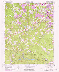
~ Chesterfield VA topo map, 1:24000 scale, 7.5 X 7.5 Minute, Historical, 1963, updated 1975
Chesterfield, Virginia, USGS topographic map dated 1963.
Includes geographic coordinates (latitude and longitude). This topographic map is suitable for hiking, camping, and exploring, or framing it as a wall map.
Printed on-demand using high resolution imagery, on heavy weight and acid free paper, or alternatively on a variety of synthetic materials.
Topos available on paper, Waterproof, Poly, or Tyvek. Usually shipping rolled, unless combined with other folded maps in one order.
- Product Number: USGS-5297192
- Free digital map download (high-resolution, GeoPDF): Chesterfield, Virginia (file size: 12 MB)
- Map Size: please refer to the dimensions of the GeoPDF map above
- Weight (paper map): ca. 55 grams
- Map Type: POD USGS Topographic Map
- Map Series: HTMC
- Map Verison: Historical
- Cell ID: 8424
- Scan ID: 184483
- Imprint Year: 1975
- Woodland Tint: Yes
- Photo Revision Year: 1974
- Aerial Photo Year: 1974
- Field Check Year: 1963
- Datum: NAD27
- Map Projection: Polyconic
- Map published by United States Geological Survey
- Map Language: English
- Scanner Resolution: 600 dpi
- Map Cell Name: Chesterfield
- Grid size: 7.5 X 7.5 Minute
- Date on map: 1963
- Map Scale: 1:24000
- Geographical region: Virginia, United States
Neighboring Maps:
All neighboring USGS topo maps are available for sale online at a variety of scales.
Spatial coverage:
Topo map Chesterfield, Virginia, covers the geographical area associated the following places:
- Manchester - Oakhaven Farms - Wedgewood - Wiseville (historical) - Kragmont - Land O'Pines - Worthington Farms - Fairpines - Five Forks - Deerfield Estates - Warwick Acres - Robinwood - Fawnbrook - Jessup Farm Acres - Runnymede - Chestnut Hill - Lake Crystal Farms - Longwood Acres - Hylton Park - Swift Creek Farms - Qualla Farms - Chesterfield Court House - Arrowhead - Falling Creek Farms - Genito Estates - Wilkinson Terrace - Shannon Terrace - Kings Forest - Pocahontas Acres - Penn Acres - Old Coach Hills - Rolling Hills - Mayfair Estates - Chesterfield
- Map Area ID: AREA37.537.375-77.625-77.5
- Northwest corner Lat/Long code: USGSNW37.5-77.625
- Northeast corner Lat/Long code: USGSNE37.5-77.5
- Southwest corner Lat/Long code: USGSSW37.375-77.625
- Southeast corner Lat/Long code: USGSSE37.375-77.5
- Northern map edge Latitude: 37.5
- Southern map edge Latitude: 37.375
- Western map edge Longitude: -77.625
- Eastern map edge Longitude: -77.5


