
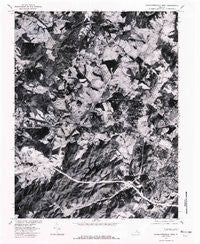
~ Charlottesville West VA topo map, 1:24000 scale, 7.5 X 7.5 Minute, Historical, 1977, updated 1982
Charlottesville West, Virginia, USGS topographic map dated 1977.
Includes geographic coordinates (latitude and longitude). This topographic map is suitable for hiking, camping, and exploring, or framing it as a wall map.
Printed on-demand using high resolution imagery, on heavy weight and acid free paper, or alternatively on a variety of synthetic materials.
Topos available on paper, Waterproof, Poly, or Tyvek. Usually shipping rolled, unless combined with other folded maps in one order.
- Product Number: USGS-5297116
- Free digital map download (high-resolution, GeoPDF): Charlottesville West, Virginia (file size: 19 MB)
- Map Size: please refer to the dimensions of the GeoPDF map above
- Weight (paper map): ca. 55 grams
- Map Type: POD USGS Topographic Map
- Map Series: HTMC
- Map Verison: Historical
- Cell ID: 8232
- Scan ID: 184434
- Imprint Year: 1982
- Aerial Photo Year: 1977
- Datum: NAD27
- Map Projection: Lambert Conformal Conic
- Orthophoto: Quad
- Map published by United States Geological Survey
- Keywords: Nonstandard Press Run
- Map Language: English
- Scanner Resolution: 600 dpi
- Map Cell Name: Charlottesville West
- Grid size: 7.5 X 7.5 Minute
- Date on map: 1977
- Map Scale: 1:24000
- Geographical region: Virginia, United States
Neighboring Maps:
All neighboring USGS topo maps are available for sale online at a variety of scales.
Spatial coverage:
Topo map Charlottesville West, Virginia, covers the geographical area associated the following places:
- Clearview Knolls - Montvue - Inglecress - Whipporwill Hollow - Oak Hill Mobile Home Park - Georgetown Green - Wyngate - Alderman Road Houses - Ivy Farms - Decca (historical) - Knollwood - Ballard Woods - Lewis Hill West - Langford - Owensville - Meriwether Hill - Barracks - Ivy Ridge - Sherwood Farms - Hessian Hills - Flordon - McCormick Road Houses - Country Green - Millington - Stadium Road Residence Area - Liberty Hill - Loch Leigh - Buckingham Circle - West Woods - University Heights - Lewis Hill East - Nob Hill - Queen Charlotte - Huntington Village - Ivy - Mill Ridge - Candlewyck - Sherwood Manor - Ivy Oaks - Farmington - Arbor Park - Waverly - Bellair - Canterbury Hills - Oak Hill - Whispering Pines - Clearview Meadows - Ednam Forest - Colthurst - Ednam - Logan Village - Reynard Woods - West Leigh - Stillfield - Ednam Village
- Map Area ID: AREA38.12538-78.625-78.5
- Northwest corner Lat/Long code: USGSNW38.125-78.625
- Northeast corner Lat/Long code: USGSNE38.125-78.5
- Southwest corner Lat/Long code: USGSSW38-78.625
- Southeast corner Lat/Long code: USGSSE38-78.5
- Northern map edge Latitude: 38.125
- Southern map edge Latitude: 38
- Western map edge Longitude: -78.625
- Eastern map edge Longitude: -78.5


