
~ Doe Mountain WA topo map, 1:24000 scale, 7.5 X 7.5 Minute, Historical, 2011
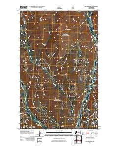
Doe Mountain, Washington, USGS topographic map dated 2011.
Includes geographic coordinates (latitude and longitude). This topographic map is suitable for hiking, camping, and exploring, or framing it as a wall map.
Printed on-demand using high resolution imagery, on heavy weight and acid free paper, or alternatively on a variety of synthetic materials.
Topos available on paper, Waterproof, Poly, or Tyvek. Usually shipping rolled, unless combined with other folded maps in one order.
- Product Number: USGS-5258703
- Free digital map download (high-resolution, GeoPDF): Doe Mountain, Washington (file size: 20 MB)
- Map Size: please refer to the dimensions of the GeoPDF map above
- Weight (paper map): ca. 55 grams
- Map Type: POD USGS Topographic Map
- Map Series: US Topo
- Map Verison: Historical
- Cell ID: 12437
- Datum: North American Datum of 1983
- Map Projection: Transverse Mercator
- Map Cell Name: Doe Mountain
- Grid size: 7.5 X 7.5 Minute
- Date on map: 2011
- Map Scale: 1:24000
- Geographical region: Washington, United States
Neighboring Maps:
All neighboring USGS topo maps are available for sale online at a variety of scales.
Spatial coverage:
Topo map Doe Mountain, Washington, covers the geographical area associated the following places:
- Doe Creek - Spring Creek - Ortell Creek - Doe Mountain - No Snake Creek - Chewuch Campground - Lamb Creek - Brevicomis Creek - Bud Creek - Deer Creek - Falls Creek Falls - Eightmile Ridge - Leroy Creek - Ike Mountain - Nice Campground - Camp Four Campground - Falls Creek Campground - Alex Creek - Sherwood Creek - Farewell Peak - Junior Creek - Lamb Butte - Buck Creek - Dodd Creek - Butte Creek - Paul Mountain - Falls Creek
- Map Area ID: AREA48.7548.625-120.25-120.125
- Northwest corner Lat/Long code: USGSNW48.75-120.25
- Northeast corner Lat/Long code: USGSNE48.75-120.125
- Southwest corner Lat/Long code: USGSSW48.625-120.25
- Southeast corner Lat/Long code: USGSSE48.625-120.125
- Northern map edge Latitude: 48.75
- Southern map edge Latitude: 48.625
- Western map edge Longitude: -120.25
- Eastern map edge Longitude: -120.125


