
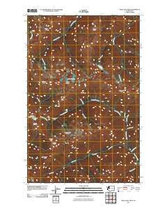
~ Wellesley Peak WA topo map, 1:24000 scale, 7.5 X 7.5 Minute, Historical, 2011
Wellesley Peak, Washington, USGS topographic map dated 2011.
Includes geographic coordinates (latitude and longitude). This topographic map is suitable for hiking, camping, and exploring, or framing it as a wall map.
Printed on-demand using high resolution imagery, on heavy weight and acid free paper, or alternatively on a variety of synthetic materials.
Topos available on paper, Waterproof, Poly, or Tyvek. Usually shipping rolled, unless combined with other folded maps in one order.
- Product Number: USGS-5257783
- Free digital map download (high-resolution, GeoPDF): Wellesley Peak, Washington (file size: 19 MB)
- Map Size: please refer to the dimensions of the GeoPDF map above
- Weight (paper map): ca. 55 grams
- Map Type: POD USGS Topographic Map
- Map Series: US Topo
- Map Verison: Historical
- Cell ID: 48024
- Datum: North American Datum of 1983
- Map Projection: Transverse Mercator
- Map Cell Name: Wellesley Peak
- Grid size: 7.5 X 7.5 Minute
- Date on map: 2011
- Map Scale: 1:24000
- Geographical region: Washington, United States
Neighboring Maps:
All neighboring USGS topo maps are available for sale online at a variety of scales.
Spatial coverage:
Topo map Wellesley Peak, Washington, covers the geographical area associated the following places:
- Hatana Falls - Wellesley Peak - Sentinel Peak - Hayden Pass - Mount Fromme - Shelter Peak - Knerr Creek - Lost Peak - Butler Creek - Cedar Creek - Burdick Creek - Cache Creek - Hidden Creek - Bear Camp - Cub Creek - Head Cameron - Dose Meadow Camp - Mount Cameron - Gray Wolf Pass - Cedar Lake - Thousand Acre Meadow - Cameron Glaciers - Cameron Pass - Sentinels Sister - Grand Pass - Camp Marion - Claywood Lake - Silt Creek - Lost Pass - Deception Creek - Mount Claywood
- Map Area ID: AREA47.87547.75-123.375-123.25
- Northwest corner Lat/Long code: USGSNW47.875-123.375
- Northeast corner Lat/Long code: USGSNE47.875-123.25
- Southwest corner Lat/Long code: USGSSW47.75-123.375
- Southeast corner Lat/Long code: USGSSE47.75-123.25
- Northern map edge Latitude: 47.875
- Southern map edge Latitude: 47.75
- Western map edge Longitude: -123.375
- Eastern map edge Longitude: -123.25


