
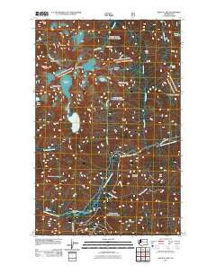
~ Blanca Lake WA topo map, 1:24000 scale, 7.5 X 7.5 Minute, Historical, 2011
Blanca Lake, Washington, USGS topographic map dated 2011.
Includes geographic coordinates (latitude and longitude). This topographic map is suitable for hiking, camping, and exploring, or framing it as a wall map.
Printed on-demand using high resolution imagery, on heavy weight and acid free paper, or alternatively on a variety of synthetic materials.
Topos available on paper, Waterproof, Poly, or Tyvek. Usually shipping rolled, unless combined with other folded maps in one order.
- Product Number: USGS-5257504
- Free digital map download (high-resolution, GeoPDF): Blanca Lake, Washington (file size: 18 MB)
- Map Size: please refer to the dimensions of the GeoPDF map above
- Weight (paper map): ca. 55 grams
- Map Type: POD USGS Topographic Map
- Map Series: US Topo
- Map Verison: Historical
- Cell ID: 4327
- Datum: North American Datum of 1983
- Map Projection: Transverse Mercator
- Map Cell Name: Blanca Lake
- Grid size: 7.5 X 7.5 Minute
- Date on map: 2011
- Map Scale: 1:24000
- Geographical region: Washington, United States
Neighboring Maps:
All neighboring USGS topo maps are available for sale online at a variety of scales.
Spatial coverage:
Topo map Blanca Lake, Washington, covers the geographical area associated the following places:
- Ida Pass - Mystery Hill (not official) - West Cady Creek - Bowser Lake - Goblin Creek - Garland Mineral Springs - Quartz Lake - San Juan Campground - Bald Eagle Mountain - Foggy Peak - Columbia Peak - Goblin Lake - Goblin Mountain - Quartz Creek - Cadet Peak - Kyes Peak - Monte Cristo Peak - Wilmans Peaks - Pride Basin - Frog Mountain - Virgin Lake - Garland Hot Springs - Columbia Glacier - San Juan Creek - Excelsior Mountain - Glacier Basin - Coney Lake - Storm Ridge - Curry Gap - Troublesome Mountain - Blanca Lake - Jack Pass
- Map Area ID: AREA4847.875-121.375-121.25
- Northwest corner Lat/Long code: USGSNW48-121.375
- Northeast corner Lat/Long code: USGSNE48-121.25
- Southwest corner Lat/Long code: USGSSW47.875-121.375
- Southeast corner Lat/Long code: USGSSE47.875-121.25
- Northern map edge Latitude: 48
- Southern map edge Latitude: 47.875
- Western map edge Longitude: -121.375
- Eastern map edge Longitude: -121.25


