
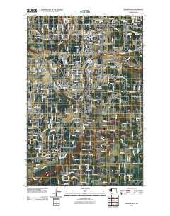
~ Frederickson WA topo map, 1:24000 scale, 7.5 X 7.5 Minute, Historical, 2011
Frederickson, Washington, USGS topographic map dated 2011.
Includes geographic coordinates (latitude and longitude). This topographic map is suitable for hiking, camping, and exploring, or framing it as a wall map.
Printed on-demand using high resolution imagery, on heavy weight and acid free paper, or alternatively on a variety of synthetic materials.
Topos available on paper, Waterproof, Poly, or Tyvek. Usually shipping rolled, unless combined with other folded maps in one order.
- Product Number: USGS-5256713
- Free digital map download (high-resolution, GeoPDF): Frederickson, Washington (file size: 17 MB)
- Map Size: please refer to the dimensions of the GeoPDF map above
- Weight (paper map): ca. 55 grams
- Map Type: POD USGS Topographic Map
- Map Series: US Topo
- Map Verison: Historical
- Cell ID: 16319
- Datum: North American Datum of 1983
- Map Projection: Transverse Mercator
- Map Cell Name: Frederickson
- Grid size: 7.5 X 7.5 Minute
- Date on map: 2011
- Map Scale: 1:24000
- Geographical region: Washington, United States
Neighboring Maps:
All neighboring USGS topo maps are available for sale online at a variety of scales.
Spatial coverage:
Topo map Frederickson, Washington, covers the geographical area associated the following places:
- Graham - Glendale Mobile Home Park - The Ridge Mobile Home Park - Berkeley - Shady Woods East and West Mobile Home Park - Deer Run Mobile Home Park - Rocky Ridge - Sunset Terrace Mobile Home Park - Country Road Estates Mobile Home Park - Hidden Glen Mobile Home Park - Woodland Estates Mobile Home Park - Americana Mobile Home Park - Country Aire Manor Mobile Home Park - Parklane Mobile Estates - Bonavilla Mobile Home Park - Shadow Pines Mobile Estates - Canyon Glen Mobile Home Park - Rainier West Mobile Home Park - Cascade Green Mobile Home Park - Little Cedars Mobile Home Park - Fir Meadows Mobile Home Park - Greenwood Mobile Home Park - Viking Mobile Home Court - Evergreen Ridge Mobile Home Park - Thrift - Tall Firs Estates Mobile Home Park - Fruitland Gardens Mobile Home Park - Meridian Terrace Mobile Manor - Evergreen Acres Mobile Home Park - Green Meadows Family Mobile Home Park - Golden Horseshoe Mobile Home Park - Cedar Crest Mobile Home Park - Frederickson - Fir Lane Valley Mobile Home Park
- Map Area ID: AREA47.12547-122.375-122.25
- Northwest corner Lat/Long code: USGSNW47.125-122.375
- Northeast corner Lat/Long code: USGSNE47.125-122.25
- Southwest corner Lat/Long code: USGSSW47-122.375
- Southeast corner Lat/Long code: USGSSE47-122.25
- Northern map edge Latitude: 47.125
- Southern map edge Latitude: 47
- Western map edge Longitude: -122.375
- Eastern map edge Longitude: -122.25


