
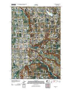
~ Auburn WA topo map, 1:24000 scale, 7.5 X 7.5 Minute, Historical, 2011
Auburn, Washington, USGS topographic map dated 2011.
Includes geographic coordinates (latitude and longitude). This topographic map is suitable for hiking, camping, and exploring, or framing it as a wall map.
Printed on-demand using high resolution imagery, on heavy weight and acid free paper, or alternatively on a variety of synthetic materials.
Topos available on paper, Waterproof, Poly, or Tyvek. Usually shipping rolled, unless combined with other folded maps in one order.
- Product Number: USGS-5256695
- Free digital map download (high-resolution, GeoPDF): Auburn, Washington (file size: 17 MB)
- Map Size: please refer to the dimensions of the GeoPDF map above
- Weight (paper map): ca. 55 grams
- Map Type: POD USGS Topographic Map
- Map Series: US Topo
- Map Verison: Historical
- Cell ID: 1822
- Datum: North American Datum of 1983
- Map Projection: Transverse Mercator
- Map Cell Name: Auburn
- Grid size: 7.5 X 7.5 Minute
- Date on map: 2011
- Map Scale: 1:24000
- Geographical region: Washington, United States
Neighboring Maps:
All neighboring USGS topo maps are available for sale online at a variety of scales.
Spatial coverage:
Topo map Auburn, Washington, covers the geographical area associated the following places:
- The River Mobile Estates - Lake Meridian Estates Mobile Home Park - Laurelwood Mobile Home Park - Horseshoe Acres Mobile Home Park - Berrydale - Cascade Mobile Villa - Auburn Manor Community Mobile Home Park - Lea Hill - Valley Mobile Manor - White River Estate Mobile Home Park - Auburn Hills Mobile Home Park - Spaids Unique Manor and Estates Mobile Home Park - Auburn Mobile Park - Skylark Village Mobile Home Park - Auburn - Tall Cedars Mobile Court - Walnut Grove Mobile Home Park - Don Juan Mobile Home Park - Lake Bowman Mobile Home Park - Stuck - Lake Money Smith Estates Mobile Home Park - Meredith - Forest Villa Manor Mobile Home Park - College Place Mobile Home Park - Leisure Manor Mobile Community - Wynaco - Skylark Village II Mobile Home Park - Shady Hill Mobile Home Park - Wildwood Mobile Home Estates - Soos Creek Mobile Home Estates - Christopher - Rio Verde Mobile Estates - Auburn Green Mobile Home Park - Thomas - Palisades Mobile Home Estates - Maple Lane Mobile Home Court
- Map Area ID: AREA47.37547.25-122.25-122.125
- Northwest corner Lat/Long code: USGSNW47.375-122.25
- Northeast corner Lat/Long code: USGSNE47.375-122.125
- Southwest corner Lat/Long code: USGSSW47.25-122.25
- Southeast corner Lat/Long code: USGSSE47.25-122.125
- Northern map edge Latitude: 47.375
- Southern map edge Latitude: 47.25
- Western map edge Longitude: -122.25
- Eastern map edge Longitude: -122.125


