
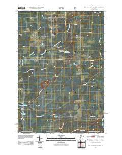
~ Jump River Fire Tower NE WI topo map, 1:24000 scale, 7.5 X 7.5 Minute, Historical, 2011
Jump River Fire Tower NE, Wisconsin, USGS topographic map dated 2011.
Includes geographic coordinates (latitude and longitude). This topographic map is suitable for hiking, camping, and exploring, or framing it as a wall map.
Printed on-demand using high resolution imagery, on heavy weight and acid free paper, or alternatively on a variety of synthetic materials.
Topos available on paper, Waterproof, Poly, or Tyvek. Usually shipping rolled, unless combined with other folded maps in one order.
- Product Number: USGS-5254859
- Free digital map download (high-resolution, GeoPDF): Jump River Fire Tower NE, Wisconsin (file size: 20 MB)
- Map Size: please refer to the dimensions of the GeoPDF map above
- Weight (paper map): ca. 55 grams
- Map Type: POD USGS Topographic Map
- Map Series: US Topo
- Map Verison: Historical
- Cell ID: 22883
- Datum: North American Datum of 1983
- Map Projection: Transverse Mercator
- Map Cell Name: Jump River Fire Tower NE
- Grid size: 7.5 X 7.5 Minute
- Date on map: 2011
- Map Scale: 1:24000
- Geographical region: Wisconsin, United States
Neighboring Maps:
All neighboring USGS topo maps are available for sale online at a variety of scales.
Spatial coverage:
Topo map Jump River Fire Tower NE, Wisconsin, covers the geographical area associated the following places:
- Steve Creek Flowage 35 - Hobbles Creek - Yellow Banks - 1 Reservoir - Town of Kennan - Lower Steve Creek 2WP1332 Dam - Meadow Creek School (historical) - Steve Creek Flowage - Fairview School (historical) - Marsh Creek - Lonely Pines Airport - Township Corners State Wildlife Management Area - Ronald Winter H1876 Dam - Town Corners Wildlife Flowage E12.67 Dam - Township Corners Flowage - Red Tile School (historical)
- Map Area ID: AREA45.545.375-90.625-90.5
- Northwest corner Lat/Long code: USGSNW45.5-90.625
- Northeast corner Lat/Long code: USGSNE45.5-90.5
- Southwest corner Lat/Long code: USGSSW45.375-90.625
- Southeast corner Lat/Long code: USGSSE45.375-90.5
- Northern map edge Latitude: 45.5
- Southern map edge Latitude: 45.375
- Western map edge Longitude: -90.625
- Eastern map edge Longitude: -90.5


