
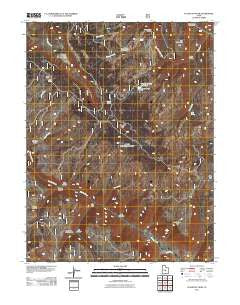
~ Flagstaff Peak UT topo map, 1:24000 scale, 7.5 X 7.5 Minute, Historical, 2011
Flagstaff Peak, Utah, USGS topographic map dated 2011.
Includes geographic coordinates (latitude and longitude). This topographic map is suitable for hiking, camping, and exploring, or framing it as a wall map.
Printed on-demand using high resolution imagery, on heavy weight and acid free paper, or alternatively on a variety of synthetic materials.
Topos available on paper, Waterproof, Poly, or Tyvek. Usually shipping rolled, unless combined with other folded maps in one order.
- Product Number: USGS-5254009
- Free digital map download (high-resolution, GeoPDF): Flagstaff Peak, Utah (file size: 24 MB)
- Map Size: please refer to the dimensions of the GeoPDF map above
- Weight (paper map): ca. 55 grams
- Map Type: POD USGS Topographic Map
- Map Series: US Topo
- Map Verison: Historical
- Cell ID: 15453
- Datum: North American Datum of 1983
- Map Projection: Transverse Mercator
- Map Cell Name: Flagstaff Peak
- Grid size: 7.5 X 7.5 Minute
- Date on map: 2011
- Map Scale: 1:24000
- Geographical region: Utah, United States
Neighboring Maps:
All neighboring USGS topo maps are available for sale online at a variety of scales.
Spatial coverage:
Topo map Flagstaff Peak, Utah, covers the geographical area associated the following places:
- Stevens Forest Service Facility - The Troughs - Ferron Canyon Campground - Ferron Canyon Overlook - The Box - Slide Hollow - Blue Lake - Flagstaff Peak - Dry Mountain - Steves Creek Administrative Site - Box Canyon - Greens Hollow - Scab Hollow - Cowboy Creek - South Sage Flat - Jason Spring - Wrigley Spring - Wrigley Springs Dam - Jason Cabin - Wrigley Springs Reservoir - Meadow Gulch - Sage Flat - Wileys Fork - Wrigley Springs Reservoir - Birch Creek - East Fork Box Canyon - Gulch Creek - Greens Canyon - Birch Spring - Last Water - Horse Creek
- Map Area ID: AREA39.12539-111.375-111.25
- Northwest corner Lat/Long code: USGSNW39.125-111.375
- Northeast corner Lat/Long code: USGSNE39.125-111.25
- Southwest corner Lat/Long code: USGSSW39-111.375
- Southeast corner Lat/Long code: USGSSE39-111.25
- Northern map edge Latitude: 39.125
- Southern map edge Latitude: 39
- Western map edge Longitude: -111.375
- Eastern map edge Longitude: -111.25


