
~ Camas Prairie WA topo map, 1:24000 scale, 7.5 X 7.5 Minute, Historical, 2011
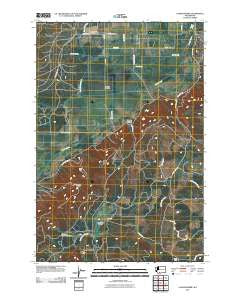
Camas Prairie, Washington, USGS topographic map dated 2011.
Includes geographic coordinates (latitude and longitude). This topographic map is suitable for hiking, camping, and exploring, or framing it as a wall map.
Printed on-demand using high resolution imagery, on heavy weight and acid free paper, or alternatively on a variety of synthetic materials.
Topos available on paper, Waterproof, Poly, or Tyvek. Usually shipping rolled, unless combined with other folded maps in one order.
- Product Number: USGS-5252816
- Free digital map download (high-resolution, GeoPDF): Camas Prairie, Washington (file size: 16 MB)
- Map Size: please refer to the dimensions of the GeoPDF map above
- Weight (paper map): ca. 55 grams
- Map Type: POD USGS Topographic Map
- Map Series: US Topo
- Map Verison: Historical
- Cell ID: 6817
- Datum: North American Datum of 1983
- Map Projection: Transverse Mercator
- Map Cell Name: Camas Prairie
- Grid size: 7.5 X 7.5 Minute
- Date on map: 2011
- Map Scale: 1:24000
- Geographical region: Washington, United States
Neighboring Maps:
All neighboring USGS topo maps are available for sale online at a variety of scales.
Spatial coverage:
Topo map Camas Prairie, Washington, covers the geographical area associated the following places:
- Whitcomb Cabin - Panakanic - Medley Canyon - Castle Spring - Chapman Creek - Panakanic Prairie - Mount Adams Cemetery - Bird Creek - Camas Prairie - Panakanic Water Works Dam - Diamond Gap Lookout - Jebe Swale - Frasier Creek - Dunkard Graveyard - Cold Springs Ditch - Log Corral Spring - Conboy Lake - Conboy Lake National Wildlife Refuge - Liberty Bond - Holmes Creek - Willard Spring
- Map Area ID: AREA4645.875-121.375-121.25
- Northwest corner Lat/Long code: USGSNW46-121.375
- Northeast corner Lat/Long code: USGSNE46-121.25
- Southwest corner Lat/Long code: USGSSW45.875-121.375
- Southeast corner Lat/Long code: USGSSE45.875-121.25
- Northern map edge Latitude: 46
- Southern map edge Latitude: 45.875
- Western map edge Longitude: -121.375
- Eastern map edge Longitude: -121.25


