
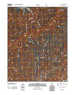
~ Signal Peak UT topo map, 1:24000 scale, 7.5 X 7.5 Minute, Historical, 2011
Signal Peak, Utah, USGS topographic map dated 2011.
Includes geographic coordinates (latitude and longitude). This topographic map is suitable for hiking, camping, and exploring, or framing it as a wall map.
Printed on-demand using high resolution imagery, on heavy weight and acid free paper, or alternatively on a variety of synthetic materials.
Topos available on paper, Waterproof, Poly, or Tyvek. Usually shipping rolled, unless combined with other folded maps in one order.
- Product Number: USGS-5252426
- Free digital map download (high-resolution, GeoPDF): Signal Peak, Utah (file size: 29 MB)
- Map Size: please refer to the dimensions of the GeoPDF map above
- Weight (paper map): ca. 55 grams
- Map Type: POD USGS Topographic Map
- Map Series: US Topo
- Map Verison: Historical
- Cell ID: 41312
- Datum: North American Datum of 1983
- Map Projection: Transverse Mercator
- Map Cell Name: Signal Peak
- Grid size: 7.5 X 7.5 Minute
- Date on map: 2011
- Map Scale: 1:24000
- Geographical region: Utah, United States
Neighboring Maps:
All neighboring USGS topo maps are available for sale online at a variety of scales.
Spatial coverage:
Topo map Signal Peak, Utah, covers the geographical area associated the following places:
- Milltown (historical) - South Valley - Browns Point Trailhead - Jones Hollow - Highline Trail - Italian Spring - Oak Grove Recreation Area - Big Hollow Trail - Seven Pines Recreation Site - Cedar Ridge - Mud Spring - Oak Grove Trail - Jones Hollow Reservoir - Upper Pines Campground - Big Cove - Big Creek - Browns Point Trail - Dan Spring - Whipple Trail - Pine Valley Recreation Area - Right Fork Santa Clara River - Pig Creek - Dry Fork - Signal Peak - Horse Creek - Deer Flat - Point Trail - Blue Springs Campground - Maple Spring - Ash Grove Spring - Big Hollow Spring - Three Pine Creek - Pines Campground - Oak Grove Campground - West Summit Trail - Danish Ranch - Further Water - Spirit Creek - Trail Peak - Whipple Trailhead - Blake Harmony Trail - Columbine Spring
- Map Area ID: AREA37.37537.25-113.5-113.375
- Northwest corner Lat/Long code: USGSNW37.375-113.5
- Northeast corner Lat/Long code: USGSNE37.375-113.375
- Southwest corner Lat/Long code: USGSSW37.25-113.5
- Southeast corner Lat/Long code: USGSSE37.25-113.375
- Northern map edge Latitude: 37.375
- Southern map edge Latitude: 37.25
- Western map edge Longitude: -113.5
- Eastern map edge Longitude: -113.375


