
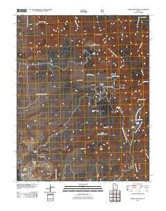
~ Saddle Mountain UT topo map, 1:24000 scale, 7.5 X 7.5 Minute, Historical, 2011
Saddle Mountain, Utah, USGS topographic map dated 2011.
Includes geographic coordinates (latitude and longitude). This topographic map is suitable for hiking, camping, and exploring, or framing it as a wall map.
Printed on-demand using high resolution imagery, on heavy weight and acid free paper, or alternatively on a variety of synthetic materials.
Topos available on paper, Waterproof, Poly, or Tyvek. Usually shipping rolled, unless combined with other folded maps in one order.
- Product Number: USGS-5252424
- Free digital map download (high-resolution, GeoPDF): Saddle Mountain, Utah (file size: 25 MB)
- Map Size: please refer to the dimensions of the GeoPDF map above
- Weight (paper map): ca. 55 grams
- Map Type: POD USGS Topographic Map
- Map Series: US Topo
- Map Verison: Historical
- Cell ID: 39140
- Datum: North American Datum of 1983
- Map Projection: Transverse Mercator
- Map Cell Name: Saddle Mountain
- Grid size: 7.5 X 7.5 Minute
- Date on map: 2011
- Map Scale: 1:24000
- Geographical region: Utah, United States
Neighboring Maps:
All neighboring USGS topo maps are available for sale online at a variety of scales.
Spatial coverage:
Topo map Saddle Mountain, Utah, covers the geographical area associated the following places:
- Big Pine Spring - West Fork Cottonwood Creek - Diamond Valley Ranch - Truman Bench - Summit Trail - Reservoir Canyon - Diamond Valley Volunteer Fire Department - Cedar Knoll - Slide Canyon - Quaking Aspen Spring - Goat Spring Trail - Mud Spring - Lone Pine Canyon - Red Knoll - Diamond Valley - Maudsley Spring - Alger Gulch - East Fork Spring - Rock Hollow Wash - Cottonwood Spring - Mahogany Knoll - Goat Spring - Middle Fork Cottonwood Creek - Rock Canyon - Goat Canyon - Carter Canyon - Cedar Knoll - Indian Hollow Spring Trail - Lower Spring - Slide Canyon Spring - Burger Peak - Saddle Mountain - Carter Canyon Spring - Washington County - East Fork Cottonwood Creek - West Fork Spring - Cougar Spring - Grass Knoll
- Map Area ID: AREA37.37537.25-113.625-113.5
- Northwest corner Lat/Long code: USGSNW37.375-113.625
- Northeast corner Lat/Long code: USGSNE37.375-113.5
- Southwest corner Lat/Long code: USGSSW37.25-113.625
- Southeast corner Lat/Long code: USGSSE37.25-113.5
- Northern map edge Latitude: 37.375
- Southern map edge Latitude: 37.25
- Western map edge Longitude: -113.625
- Eastern map edge Longitude: -113.5


