
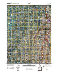
~ Roy UT topo map, 1:24000 scale, 7.5 X 7.5 Minute, Historical, 2011
Roy, Utah, USGS topographic map dated 2011.
Includes geographic coordinates (latitude and longitude). This topographic map is suitable for hiking, camping, and exploring, or framing it as a wall map.
Printed on-demand using high resolution imagery, on heavy weight and acid free paper, or alternatively on a variety of synthetic materials.
Topos available on paper, Waterproof, Poly, or Tyvek. Usually shipping rolled, unless combined with other folded maps in one order.
- Product Number: USGS-5252120
- Free digital map download (high-resolution, GeoPDF): Roy, Utah (file size: 20 MB)
- Map Size: please refer to the dimensions of the GeoPDF map above
- Weight (paper map): ca. 55 grams
- Map Type: POD USGS Topographic Map
- Map Series: US Topo
- Map Verison: Historical
- Cell ID: 38825
- Datum: North American Datum of 1983
- Map Projection: Transverse Mercator
- Map Cell Name: Roy
- Grid size: 7.5 X 7.5 Minute
- Date on map: 2011
- Map Scale: 1:24000
- Geographical region: Utah, United States
Neighboring Maps:
All neighboring USGS topo maps are available for sale online at a variety of scales.
Spatial coverage:
Topo map Roy, Utah, covers the geographical area associated the following places:
- Shamrock - Maybrook - Barton-Thompson - Swan Creek Estates - Apple Estates - Linda Vista - Kingsville Junction - Barton - Sandalwood Square - Hatch - West Hills - Parks - Berrett - Lawndale Addition - Elta Glen - Diamond Hills - Arsenal - Bonham - Aspen West - Kanesville - Holley and Whitney - Val-Jo - Arthur Jones Estate - Lewis Estates - Lucin - Eves Garden - Page Estates - Country Park - West Haven - Kelley Kay Acres - Alpine Ranchettes - Carriage Lane Number Two - Lakeside Park - Colonial Plaza Condominium - DeGiorgio - Midland Farms - Enchanted Homes Addition - Glade-Nelson - La Loma - Quail Point - Sunrise Park - Chateau-Park Condominium - Pleasant View - Pinto Acres - Tullis Addition - Midland Square - Pony Acres Estates - Northpoint Condominium - Lincoln Court Condominium - Valley View Acres - Town and Country Estates - Municipal Acres - Raymond Shupe Addition - Westbrook - Country Lane - Peppermint Park - Linda Vista - Sherwood Oaks Condominium - Foxglen - West Weber - Lavell - Allred - Loma Bonita - Lakeview Equestrian Park - Cedar Ridge Number Tow - Christensen - Kentwood Condominium - Tubbs - Royset Park Addition and Annex - Rich Acres - Sunset Dale - Hal-Vern Park Addition - Donita - Country Homes - Olivewood Park - Scotts Dale - Holley Acres - Lemans - Sandridge Estates - Western Willows Cluster - West View Park - Marianne Condominium - Kap - West Side Estates - Gilene - Herefordshire Condominium - Suburban Heights - Carriage Place - Sunset Dale - Evona - Fairmount Park - The Parsons Place - Clinton - The Hillsite Addition - Jill - English Manor - Pheasant Run Estates - Commonwealth Square - Pony Acres Estates - Willow Wood
- Map Area ID: AREA41.2541.125-112.125-112
- Northwest corner Lat/Long code: USGSNW41.25-112.125
- Northeast corner Lat/Long code: USGSNE41.25-112
- Southwest corner Lat/Long code: USGSSW41.125-112.125
- Southeast corner Lat/Long code: USGSSE41.125-112
- Northern map edge Latitude: 41.25
- Southern map edge Latitude: 41.125
- Western map edge Longitude: -112.125
- Eastern map edge Longitude: -112


