
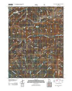
~ Wolf Creek Summit UT topo map, 1:24000 scale, 7.5 X 7.5 Minute, Historical, 2011
Wolf Creek Summit, Utah, USGS topographic map dated 2011.
Includes geographic coordinates (latitude and longitude). This topographic map is suitable for hiking, camping, and exploring, or framing it as a wall map.
Printed on-demand using high resolution imagery, on heavy weight and acid free paper, or alternatively on a variety of synthetic materials.
Topos available on paper, Waterproof, Poly, or Tyvek. Usually shipping rolled, unless combined with other folded maps in one order.
- Product Number: USGS-5249917
- Free digital map download (high-resolution, GeoPDF): Wolf Creek Summit, Utah (file size: 21 MB)
- Map Size: please refer to the dimensions of the GeoPDF map above
- Weight (paper map): ca. 55 grams
- Map Type: POD USGS Topographic Map
- Map Series: US Topo
- Map Verison: Historical
- Cell ID: 49649
- Datum: North American Datum of 1983
- Map Projection: Transverse Mercator
- Map Cell Name: Wolf Creek Summit
- Grid size: 7.5 X 7.5 Minute
- Date on map: 2011
- Map Scale: 1:24000
- Geographical region: Utah, United States
Neighboring Maps:
All neighboring USGS topo maps are available for sale online at a variety of scales.
Spatial coverage:
Topo map Wolf Creek Summit, Utah, covers the geographical area associated the following places:
- Scotty Basin - Trail Hollow - Buck Knoll - Mill Hollow Campground - Vat Creek Ridge - Duchesne Ridge - East Fork Mill Hollow - Camp Hollow - Neeley Basin - Washout Gulch - Wolf Creek Campground - Vat Creek - Corral Hollow - Yellow Lake - Mill Hollow Guard Station - Sandstone Basin - Beef Pasture - Campbell Hollow - Wolf Creek Summit - Little West Fork - Wolf Creek Peak - Pass Creek - Death Hollow - Shale Ridge - Coyote Ridge - Coleman Basin - Jimmies Basin - Jones Basin - Low Pass - Heart Lake - Bills Basin - Mill Hollow Reservoir - White Ledge - Mill Hollow Dam - Vat Tunnel - Red Creek Mountain - Becky Basin - Mill Hollow Granite School Center - Telephone Hollow
- Map Area ID: AREA40.540.375-111.125-111
- Northwest corner Lat/Long code: USGSNW40.5-111.125
- Northeast corner Lat/Long code: USGSNE40.5-111
- Southwest corner Lat/Long code: USGSSW40.375-111.125
- Southeast corner Lat/Long code: USGSSE40.375-111
- Northern map edge Latitude: 40.5
- Southern map edge Latitude: 40.375
- Western map edge Longitude: -111.125
- Eastern map edge Longitude: -111


