
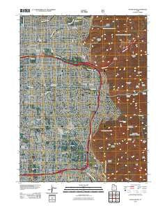
~ Sugar House UT topo map, 1:24000 scale, 7.5 X 7.5 Minute, Historical, 2011
Sugar House, Utah, USGS topographic map dated 2011.
Includes geographic coordinates (latitude and longitude). This topographic map is suitable for hiking, camping, and exploring, or framing it as a wall map.
Printed on-demand using high resolution imagery, on heavy weight and acid free paper, or alternatively on a variety of synthetic materials.
Topos available on paper, Waterproof, Poly, or Tyvek. Usually shipping rolled, unless combined with other folded maps in one order.
- Product Number: USGS-5249909
- Free digital map download (high-resolution, GeoPDF): Sugar House, Utah (file size: 24 MB)
- Map Size: please refer to the dimensions of the GeoPDF map above
- Weight (paper map): ca. 55 grams
- Map Type: POD USGS Topographic Map
- Map Series: US Topo
- Map Verison: Historical
- Cell ID: 43619
- Datum: North American Datum of 1983
- Map Projection: Transverse Mercator
- Map Cell Name: Sugar House
- Grid size: 7.5 X 7.5 Minute
- Date on map: 2011
- Map Scale: 1:24000
- Geographical region: Utah, United States
Neighboring Maps:
All neighboring USGS topo maps are available for sale online at a variety of scales.
Spatial coverage:
Topo map Sugar House, Utah, covers the geographical area associated the following places:
- White Circle - Executive Suites of Fountain East - Wren Circle Condominium - Holladay Heights - Mount Olympus Park - Paul - Holladay Village Condominium - Aix La Chapelle Condominium - Chevy Chase - Holladay Edgehill - C Barton Grover - Akron - Ballard - Greenfield Village - Woodridge Terrace - Waterbury Condominium - Rothmoor Estates - Cambria Pines - Wasatch Village - Arborwood Park - Standia - Woodbury - Carsey Acres - Flamingo Hills - Arbor Estates Condominium - East Holladay Condominium - Adams Park - Briarcreek Condominium - Yalecrest Park - Cottonwood Glade - Mount Athena - Brockwood - Johnsonville - West Grand View - Lazy Bar - Rosalie Heights - Midland Court Condominium - Country Manor - Peony Gardens - Shady Grove - Phylden - Young Haven Circle - North Shadow Mountain Estates - Sleepy Hollow Two - Holiday Center Addition - Murray Condominium - Shangrila - Whitaker - Orchard Gardens - Mount Olympus Cove - Woodstock Village - Heughs Canyon - Jeremy - Belle Meadows - Cliffwood Park - Eastview - Holladay Manor - Spring Creek Estates - East Olympus Heights - Carters Circle - Laura Park - Olympus Heights - Cottonwood - Village Three Condominium - Brookwood Condominiums - Mount Olympus - Windsor Place - Raintree East - Ellison Woods - Olympus View Heights - Holladay Circle - Fors - Bay - Southwood Three and Four - Spring Hill Condominium - Oakwood Acres - Powell Circle - Floribunda Heights - Ewell - Casto Pines Condominium - Milo - Tidewater Village Condominium - Mount Olympus Gardens Condominium - Jo Lynn - Donjean - Nalani - Fairview Gardens - Vista Village - Hamilton Village - Fairbrook Condominium - Holladay East - Southwood Two - Ethel Gardens - Oakcrest - Olympus Shadows Estates - Briarwood Hills - Holladay Hills - Carriage Lane Condominium - Mount Olympus Acres - Nielson
- Map Area ID: AREA40.7540.625-111.875-111.75
- Northwest corner Lat/Long code: USGSNW40.75-111.875
- Northeast corner Lat/Long code: USGSNE40.75-111.75
- Southwest corner Lat/Long code: USGSSW40.625-111.875
- Southeast corner Lat/Long code: USGSSE40.625-111.75
- Northern map edge Latitude: 40.75
- Southern map edge Latitude: 40.625
- Western map edge Longitude: -111.875
- Eastern map edge Longitude: -111.75


