
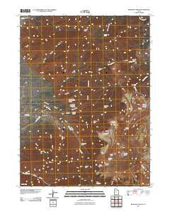
~ Bingham Canyon UT topo map, 1:24000 scale, 7.5 X 7.5 Minute, Historical, 2011
Bingham Canyon, Utah, USGS topographic map dated 2011.
Includes geographic coordinates (latitude and longitude). This topographic map is suitable for hiking, camping, and exploring, or framing it as a wall map.
Printed on-demand using high resolution imagery, on heavy weight and acid free paper, or alternatively on a variety of synthetic materials.
Topos available on paper, Waterproof, Poly, or Tyvek. Usually shipping rolled, unless combined with other folded maps in one order.
- Product Number: USGS-5249451
- Free digital map download (high-resolution, GeoPDF): Bingham Canyon, Utah (file size: 21 MB)
- Map Size: please refer to the dimensions of the GeoPDF map above
- Weight (paper map): ca. 55 grams
- Map Type: POD USGS Topographic Map
- Map Series: US Topo
- Map Verison: Historical
- Cell ID: 3950
- Datum: North American Datum of 1983
- Map Projection: Transverse Mercator
- Map Cell Name: Bingham Canyon
- Grid size: 7.5 X 7.5 Minute
- Date on map: 2011
- Map Scale: 1:24000
- Geographical region: Utah, United States
Neighboring Maps:
All neighboring USGS topo maps are available for sale online at a variety of scales.
Spatial coverage:
Topo map Bingham Canyon, Utah, covers the geographical area associated the following places:
- Archers Canyon - Apex Tunnel - Crystal Spring - Curry Peak - Pine Creek - Clipper Ridge - Barneys Peak - Spring Canyon - Pole Canyon - Apex Shaft - KCPX-FM (Salt Lake City) - Dry Canyon - International - Leavetts Canyon - Highland Tunnel - KALL-FM (Salt Lake City) - Chandler Cemetery - Freeman Peak - Anaconda Reservoir - KTVX-TV (Salt Lake City) - Swensons Canyon - Baltimore Gulch - Sap Gulch - Nelson Peak - KUED-TV (Salt Lake City) - Freeman Gulch - KUTV-TV (Salt Lake City) - South Fork Swensons Canyon - Markham Peak - Oquirrh Mountains - Pine Canyon - KUTV-TV (Salt Lake City) - Clipper Peak - Bingham Canyon - Township of Copperton - North Fork Swensons Canyon - KBYU-FM (Provo) - KBYU-TV (Provo) - KUER-FM (Salt Lake City) - Anaconda Tailing Dam - Bear Hollow - Markham Gulch - Dry Fork Bingham Canyon - West Mountain - Pass Canyon - Bingham Copper Mine - Bingham West Dip Tunnel - KCPX-FM (Salt Lake City) - Armstrong Tunnel - Flood Canyon
- Map Area ID: AREA40.62540.5-112.25-112.125
- Northwest corner Lat/Long code: USGSNW40.625-112.25
- Northeast corner Lat/Long code: USGSNE40.625-112.125
- Southwest corner Lat/Long code: USGSSW40.5-112.25
- Southeast corner Lat/Long code: USGSSE40.5-112.125
- Northern map edge Latitude: 40.625
- Southern map edge Latitude: 40.5
- Western map edge Longitude: -112.25
- Eastern map edge Longitude: -112.125


