
~ Rilda Canyon UT topo map, 1:24000 scale, 7.5 X 7.5 Minute, Historical, 2011
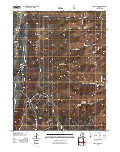
Rilda Canyon, Utah, USGS topographic map dated 2011.
Includes geographic coordinates (latitude and longitude). This topographic map is suitable for hiking, camping, and exploring, or framing it as a wall map.
Printed on-demand using high resolution imagery, on heavy weight and acid free paper, or alternatively on a variety of synthetic materials.
Topos available on paper, Waterproof, Poly, or Tyvek. Usually shipping rolled, unless combined with other folded maps in one order.
- Product Number: USGS-5247224
- Free digital map download (high-resolution, GeoPDF): Rilda Canyon, Utah (file size: 24 MB)
- Map Size: please refer to the dimensions of the GeoPDF map above
- Weight (paper map): ca. 55 grams
- Map Type: POD USGS Topographic Map
- Map Series: US Topo
- Map Verison: Historical
- Cell ID: 37918
- Datum: North American Datum of 1983
- Map Projection: Transverse Mercator
- Map Cell Name: Rilda Canyon
- Grid size: 7.5 X 7.5 Minute
- Date on map: 2011
- Map Scale: 1:24000
- Geographical region: Utah, United States
Neighboring Maps:
All neighboring USGS topo maps are available for sale online at a variety of scales.
Spatial coverage:
Topo map Rilda Canyon, Utah, covers the geographical area associated the following places:
- Flat Canyon - Scad Valley - Left Fork Huntington Creek - Coenwal Mine - Manti-La Sal National Forest - Manti Division - Grange Hole - Mill Fork - Indian Creek Campground - Crandall Canyon - Trail Mountain - Vicks Canyon - Marinus Canyon - Right Fork Rilda Canyon - Upper Joes Valley Guard Station - Left Fork Rilda Canyon - Spoon Creek - Upper Joes Valley - Bald Ridge - Little Bear Canyon - Tie Fork Canyon - Horse Creek - Horse Canyon - Blind Canyon - Paradise Creek - Hunington Number 4 Mine - Biddlecome Hollow - East Mountain - Winks Canyon
- Map Area ID: AREA39.539.375-111.25-111.125
- Northwest corner Lat/Long code: USGSNW39.5-111.25
- Northeast corner Lat/Long code: USGSNE39.5-111.125
- Southwest corner Lat/Long code: USGSSW39.375-111.25
- Southeast corner Lat/Long code: USGSSE39.375-111.125
- Northern map edge Latitude: 39.5
- Southern map edge Latitude: 39.375
- Western map edge Longitude: -111.25
- Eastern map edge Longitude: -111.125


