
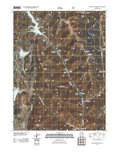
~ Candland Mountain UT topo map, 1:24000 scale, 7.5 X 7.5 Minute, Historical, 2011
Candland Mountain, Utah, USGS topographic map dated 2011.
Includes geographic coordinates (latitude and longitude). This topographic map is suitable for hiking, camping, and exploring, or framing it as a wall map.
Printed on-demand using high resolution imagery, on heavy weight and acid free paper, or alternatively on a variety of synthetic materials.
Topos available on paper, Waterproof, Poly, or Tyvek. Usually shipping rolled, unless combined with other folded maps in one order.
- Product Number: USGS-5247184
- Free digital map download (high-resolution, GeoPDF): Candland Mountain, Utah (file size: 23 MB)
- Map Size: please refer to the dimensions of the GeoPDF map above
- Weight (paper map): ca. 55 grams
- Map Type: POD USGS Topographic Map
- Map Series: US Topo
- Map Verison: Historical
- Cell ID: 7026
- Datum: North American Datum of 1983
- Map Projection: Transverse Mercator
- Map Cell Name: Candland Mountain
- Grid size: 7.5 X 7.5 Minute
- Date on map: 2011
- Map Scale: 1:24000
- Geographical region: Utah, United States
Neighboring Maps:
All neighboring USGS topo maps are available for sale online at a variety of scales.
Spatial coverage:
Topo map Candland Mountain, Utah, covers the geographical area associated the following places:
- Hughes Canyon - Miller Flat Dam - Nuck Woodward Canyon - Second Canyon - South Hughes Canyon - Valentines Gulch - Day Canyon - Scad Valley Creek - Old Folks Flat Campground - Ragman Canyon - Old Fireside Mine - Trough Springs Ridge - Miller Flat Reservoir - Corral Canyon - Forks of Huntington Campground - North Hughes Canyon - Yellow Brush Flat - Sawmill Canyon - Fireside Mine - Miller Flat Creek - Cox Canyon - McElprang Canyon - Monument Peak - Electric Lake Dam - Engineer Canyon - Flood Canyon - Hog Flat - Huntington Mine - Little Eccles Canyon - Coal Canyon - Pole Canyon - Lake Canyon - Short Canyon - Mill Canyon - Cleveland Dam - Bald Mountain - Stuart Guard Station - Cleveland Reservoir - Staker Canyon - Bear Canyon - Candland Mountain - Seeley Mountain - First Canyon - Sulphur Spring - Old Larsen Mine - Electric Lake
- Map Area ID: AREA39.62539.5-111.25-111.125
- Northwest corner Lat/Long code: USGSNW39.625-111.25
- Northeast corner Lat/Long code: USGSNE39.625-111.125
- Southwest corner Lat/Long code: USGSSW39.5-111.25
- Southeast corner Lat/Long code: USGSSE39.5-111.125
- Northern map edge Latitude: 39.625
- Southern map edge Latitude: 39.5
- Western map edge Longitude: -111.25
- Eastern map edge Longitude: -111.125


