
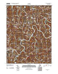
~ Rivesville WV topo map, 1:24000 scale, 7.5 X 7.5 Minute, Historical, 2011
Rivesville, West Virginia, USGS topographic map dated 2011.
Includes geographic coordinates (latitude and longitude). This topographic map is suitable for hiking, camping, and exploring, or framing it as a wall map.
Printed on-demand using high resolution imagery, on heavy weight and acid free paper, or alternatively on a variety of synthetic materials.
Topos available on paper, Waterproof, Poly, or Tyvek. Usually shipping rolled, unless combined with other folded maps in one order.
- Product Number: USGS-5242123
- Free digital map download (high-resolution, GeoPDF): Rivesville, West Virginia (file size: 24 MB)
- Map Size: please refer to the dimensions of the GeoPDF map above
- Weight (paper map): ca. 55 grams
- Map Type: POD USGS Topographic Map
- Map Series: US Topo
- Map Verison: Historical
- Cell ID: 71413
- Datum: North American Datum of 1983
- Map Projection: Transverse Mercator
- Map Cell Name: Rivesville
- Grid size: 7.5 X 7.5 Minute
- Date on map: 2011
- Map Scale: 1:24000
- Geographical region: West Virginia, United States
Neighboring Maps:
All neighboring USGS topo maps are available for sale online at a variety of scales.
Spatial coverage:
Topo map Rivesville, West Virginia, covers the geographical area associated the following places:
- Crown - Arnettsville - Mount Harmony - Richwood (historical) - Booth - Smithville - Lowsville - Pleasant View - National - Delmar - Flaggy Meadow - Everettville - Viola - Jordan - Radcliff - Edna - Ridge Farms - Laurel Point - Fort Grand - Montana - Georgetown - Opekiska - Smithtown - Catawba - Osgood - Rivesville
- Map Area ID: AREA39.62539.5-80.125-80
- Northwest corner Lat/Long code: USGSNW39.625-80.125
- Northeast corner Lat/Long code: USGSNE39.625-80
- Southwest corner Lat/Long code: USGSSW39.5-80.125
- Southeast corner Lat/Long code: USGSSE39.5-80
- Northern map edge Latitude: 39.625
- Southern map edge Latitude: 39.5
- Western map edge Longitude: -80.125
- Eastern map edge Longitude: -80


