
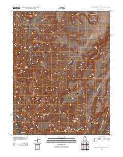
~ South Six shooter Peak UT topo map, 1:24000 scale, 7.5 X 7.5 Minute, Historical, 2010
South Six shooter Peak, Utah, USGS topographic map dated 2010.
Includes geographic coordinates (latitude and longitude). This topographic map is suitable for hiking, camping, and exploring, or framing it as a wall map.
Printed on-demand using high resolution imagery, on heavy weight and acid free paper, or alternatively on a variety of synthetic materials.
Topos available on paper, Waterproof, Poly, or Tyvek. Usually shipping rolled, unless combined with other folded maps in one order.
- Product Number: USGS-5239200
- Free digital map download (high-resolution, GeoPDF): South Six shooter Peak, Utah (file size: 26 MB)
- Map Size: please refer to the dimensions of the GeoPDF map above
- Weight (paper map): ca. 55 grams
- Map Type: POD USGS Topographic Map
- Map Series: US Topo
- Map Verison: Historical
- Cell ID: 42297
- Datum: North American Datum of 1983
- Map Projection: Transverse Mercator
- Map Cell Name: South Six-shooter Peak
- Grid size: 7.5 X 7.5 Minute
- Date on map: 2010
- Map Scale: 1:24000
- Geographical region: Utah, United States
Neighboring Maps:
All neighboring USGS topo maps are available for sale online at a variety of scales.
Spatial coverage:
Topo map South Six shooter Peak, Utah, covers the geographical area associated the following places:
- Fortress Arch - West Fork Lavender Creek - Hand Hold Arch - Gothic Arch - Anchor Arch - Tower Ruin - Dry Fork Canyon - South Sixshooter Peak - Keyhole Ruins - Natural Arch - Thirteen Faces - Fisheye Arch - Long Arch - Castle Arch - Davis Canyon - Caterpillar Arch - Paul Bunyans Potty - Gunsight Natural Bridge
- Map Area ID: AREA38.12538-109.75-109.625
- Northwest corner Lat/Long code: USGSNW38.125-109.75
- Northeast corner Lat/Long code: USGSNE38.125-109.625
- Southwest corner Lat/Long code: USGSSW38-109.75
- Southeast corner Lat/Long code: USGSSE38-109.625
- Northern map edge Latitude: 38.125
- Southern map edge Latitude: 38
- Western map edge Longitude: -109.75
- Eastern map edge Longitude: -109.625


