
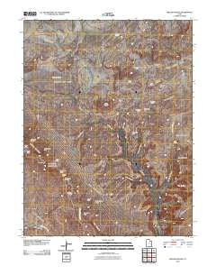
~ Mollie Hogans UT topo map, 1:24000 scale, 7.5 X 7.5 Minute, Historical, 2010
Mollie Hogans, Utah, USGS topographic map dated 2010.
Includes geographic coordinates (latitude and longitude). This topographic map is suitable for hiking, camping, and exploring, or framing it as a wall map.
Printed on-demand using high resolution imagery, on heavy weight and acid free paper, or alternatively on a variety of synthetic materials.
Topos available on paper, Waterproof, Poly, or Tyvek. Usually shipping rolled, unless combined with other folded maps in one order.
- Product Number: USGS-5239192
- Free digital map download (high-resolution, GeoPDF): Mollie Hogans, Utah (file size: 21 MB)
- Map Size: please refer to the dimensions of the GeoPDF map above
- Weight (paper map): ca. 55 grams
- Map Type: POD USGS Topographic Map
- Map Series: US Topo
- Map Verison: Historical
- Cell ID: 29795
- Datum: North American Datum of 1983
- Map Projection: Transverse Mercator
- Map Cell Name: Mollie Hogans
- Grid size: 7.5 X 7.5 Minute
- Date on map: 2010
- Map Scale: 1:24000
- Geographical region: Utah, United States
Neighboring Maps:
All neighboring USGS topo maps are available for sale online at a variety of scales.
Spatial coverage:
Topo map Mollie Hogans, Utah, covers the geographical area associated the following places:
- Wall Arch (historical) - Yellow Cat Wash - Cottonwood Wash - Little Eva Mine - Dry Oak Spring - Agate Wash - Little Valley - Navajo Arch - Black Cave Arch - Partition Arch - Devils Garden - Yellow Bird Mine - Memphis Mines - Devils Garden Trailhead - Mine Draw - Box Arch - Fin Canyon - Broken Arch - Box Arch - Clover Canyon Bridge - Memphis Hill - Telluride Mines - Turban Head Arch - Sand Dune Arch - Lemon Airport (historical) - Ringtail Mine - Gothic Arch - Parco Mines - Johns Incline - The Biscuits - Clover Canyon - Double O Arch - Black Ape Mine - Lost Spring - Lost Spring Canyon - Pine Tree Arch - Piano Leg Arch - Blackstone Incline - Arch de Triumphe - Crystal Arch - Fiery Furnace - Fish Seep Draw - Yellow Cat Flat - Landscape Arch - Coke Oven Arch - Shadow Box Arch - Skyline Arch - Yellow Cat Mesa - Mollie Hogans - Tunnel Arch - Oval Canyon Natural Bridge - Bat Guano Arch - Top Story Window - Tapestry Arch
- Map Area ID: AREA38.87538.75-109.625-109.5
- Northwest corner Lat/Long code: USGSNW38.875-109.625
- Northeast corner Lat/Long code: USGSNE38.875-109.5
- Southwest corner Lat/Long code: USGSSW38.75-109.625
- Southeast corner Lat/Long code: USGSSE38.75-109.5
- Northern map edge Latitude: 38.875
- Southern map edge Latitude: 38.75
- Western map edge Longitude: -109.625
- Eastern map edge Longitude: -109.5


