
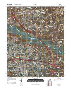
~ Seven Pines VA topo map, 1:24000 scale, 7.5 X 7.5 Minute, Historical, 2010
Seven Pines, Virginia, USGS topographic map dated 2010.
Includes geographic coordinates (latitude and longitude). This topographic map is suitable for hiking, camping, and exploring, or framing it as a wall map.
Printed on-demand using high resolution imagery, on heavy weight and acid free paper, or alternatively on a variety of synthetic materials.
Topos available on paper, Waterproof, Poly, or Tyvek. Usually shipping rolled, unless combined with other folded maps in one order.
- Product Number: USGS-5232584
- Free digital map download (high-resolution, GeoPDF): Seven Pines, Virginia (file size: 21 MB)
- Map Size: please refer to the dimensions of the GeoPDF map above
- Weight (paper map): ca. 55 grams
- Map Type: POD USGS Topographic Map
- Map Series: US Topo
- Map Verison: Historical
- Cell ID: 40633
- Datum: North American Datum of 1983
- Map Projection: Transverse Mercator
- Map Cell Name: Seven Pines
- Grid size: 7.5 X 7.5 Minute
- Date on map: 2010
- Map Scale: 1:24000
- Geographical region: Virginia, United States
Neighboring Maps:
All neighboring USGS topo maps are available for sale online at a variety of scales.
Spatial coverage:
Topo map Seven Pines, Virginia, covers the geographical area associated the following places:
- Beaties Mill - New Cold Harbor - Sandston Highland - Barkers Mill - Windsor Place - Dogwood Knoll - Fair Oaks - Woodlawn Terrace - Fairlawn Heights - Valley Oaks - Robinwood - Sanburne Park - Pine Heights - Manbur - Eastover Gardens - Simpkins Corner - Forest Meadow Mobile Home Park - Kirbytown - Old Cold Harbor - Ellerson Mill - Virginia Heights - Seven Pines - Lee Park - Hanover Farms - Walnut Grove - Lewis Gardens - Spring Meadows - Gaines Mill - Sandston - Lawndale Farms - Gilbert Gardens - White Oak Swamp - Heckler Village - Cold Harbor Farms - Stonewall Estates - Mechanicsville - Brandy Creek Estates - Highland Springs
- Map Area ID: AREA37.62537.5-77.375-77.25
- Northwest corner Lat/Long code: USGSNW37.625-77.375
- Northeast corner Lat/Long code: USGSNE37.625-77.25
- Southwest corner Lat/Long code: USGSSW37.5-77.375
- Southeast corner Lat/Long code: USGSSE37.5-77.25
- Northern map edge Latitude: 37.625
- Southern map edge Latitude: 37.5
- Western map edge Longitude: -77.375
- Eastern map edge Longitude: -77.25


