
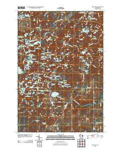
~ Bob Lake WI topo map, 1:24000 scale, 7.5 X 7.5 Minute, Historical, 2010
Bob Lake, Wisconsin, USGS topographic map dated 2010.
Includes geographic coordinates (latitude and longitude). This topographic map is suitable for hiking, camping, and exploring, or framing it as a wall map.
Printed on-demand using high resolution imagery, on heavy weight and acid free paper, or alternatively on a variety of synthetic materials.
Topos available on paper, Waterproof, Poly, or Tyvek. Usually shipping rolled, unless combined with other folded maps in one order.
- Product Number: USGS-5232123
- Free digital map download (high-resolution, GeoPDF): Bob Lake, Wisconsin (file size: 25 MB)
- Map Size: please refer to the dimensions of the GeoPDF map above
- Weight (paper map): ca. 55 grams
- Map Type: POD USGS Topographic Map
- Map Series: US Topo
- Map Verison: Historical
- Cell ID: 4636
- Datum: North American Datum of 1983
- Map Projection: Transverse Mercator
- Map Cell Name: Bob Lake
- Grid size: 7.5 X 7.5 Minute
- Date on map: 2010
- Map Scale: 1:24000
- Geographical region: Wisconsin, United States
Neighboring Maps:
All neighboring USGS topo maps are available for sale online at a variety of scales.
Spatial coverage:
Topo map Bob Lake, Wisconsin, covers the geographical area associated the following places:
- Point View School (historical) - Baldy Mountain - O'Neil Flowage 0.2 - Little Buck Lake - Bob Lake School (historical) - Long Lake - O'Neil Creek Flowage Trail - Himple Lake - Dorothy Lake - Little Plummer Lake - Rat Lake - Picnic Lake - Camp Nawakwa - Planning Lake - Deer Lake - Black Lake - Round Lake - Lowland Lake - Cleveland Center School (historical) - Sand Lake - Deer Fly Trail - Plummer Lake - O'Neil Creek Flowage Number One - Clear Lake - Little Twin Lake - Fishpole Lake - Triple Lakes - Keystone Church - O'Neil Flowage 0.5 - Silver Lake - Metcalf Lake - Willow Creek Flowage Number Three - Twin Lakes - Barr Lake - Nut Lake - Trinity Church - Eagle Lake - Willow Creek Flowage Number 3 E12.52 Dam - Beaver Lake - Hay Lake - Stanley Lake - Long Lake - Evergreen Lake - Hickory Ridge Trail - Mary Jane Lake - Highland Lake - Rassmusson Lake - Bass Lakes - Number One Lake - Town of Cleveland - Spring Creek Dairy - Willow Creek Flowage 3 - O'Neil Creek Flowage Number Two - Maplewood School (historical) - Silver Bass Lake - Dam Lake - Pauls Lake - O'Neil Flowage 2 E12.206 Dam - Beaver Lake - Keystone School (historical) - Star Lake - Town Line Lake - Hay Meadow Flowage - Hemlock Lake - Rock Lake - Odd Lake - Kettle Lake - Dumke Lake - Bass Lake - Evans Lake - Sunfish Lake - Beaver Lake - Burnt Wagon Lake - Oliver Lakes - Moon Lake - Mud Lake - Tamarack Lake - Pickerel Lake - Cleveland Townhall - Lowers Lake - O'Neil Flowage 1 E12.206 Dam - Horseshoe Lake - Rattz Lake - Conley E3663 1 Dam - Riley Lake - Roger Lake - Big Buck Lake - Horseshoe Lake - Highland School (historical) - Popple Point Lake - Bob Lake - Harwood Lakes - Tram Lake - Boiler Lake - West Lake - Dog Island Lake - Spring Creek Flowage Number One - Big Twin Lake - Hay Meadow Trail - Meadows Lake
- Map Area ID: AREA45.2545.125-91.375-91.25
- Northwest corner Lat/Long code: USGSNW45.25-91.375
- Northeast corner Lat/Long code: USGSNE45.25-91.25
- Southwest corner Lat/Long code: USGSSW45.125-91.375
- Southeast corner Lat/Long code: USGSSE45.125-91.25
- Northern map edge Latitude: 45.25
- Southern map edge Latitude: 45.125
- Western map edge Longitude: -91.375
- Eastern map edge Longitude: -91.25


