
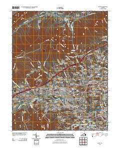
~ Salem VA topo map, 1:24000 scale, 7.5 X 7.5 Minute, Historical, 2010
Salem, Virginia, USGS topographic map dated 2010.
Includes geographic coordinates (latitude and longitude). This topographic map is suitable for hiking, camping, and exploring, or framing it as a wall map.
Printed on-demand using high resolution imagery, on heavy weight and acid free paper, or alternatively on a variety of synthetic materials.
Topos available on paper, Waterproof, Poly, or Tyvek. Usually shipping rolled, unless combined with other folded maps in one order.
- Product Number: USGS-5229297
- Free digital map download (high-resolution, GeoPDF): Salem, Virginia (file size: 27 MB)
- Map Size: please refer to the dimensions of the GeoPDF map above
- Weight (paper map): ca. 55 grams
- Map Type: POD USGS Topographic Map
- Map Series: US Topo
- Map Verison: Historical
- Cell ID: 39424
- Datum: North American Datum of 1983
- Map Projection: Transverse Mercator
- Map Cell Name: Salem
- Grid size: 7.5 X 7.5 Minute
- Date on map: 2010
- Map Scale: 1:24000
- Geographical region: Virginia, United States
Neighboring Maps:
All neighboring USGS topo maps are available for sale online at a variety of scales.
Spatial coverage:
Topo map Salem, Virginia, covers the geographical area associated the following places:
- Beacon Hills - Burwell - Medley - Southdowns - Cameron Court - Crestmoor Court - Pine Oak Heights - Hemlock Hills - Riverland Court - Moneiro - Green Hill Terrace - Westchester Court - Foxwood - Stonegate - Oak Park - Fort Lewis Terrace - Huddleston Court - Mill Road Park - Shamrock - Lee Hy Park - Deep Dell - Dropmore - West Park - Quail Crossing - Oak Ridge - Mountain Heights East - Mountain View - Mountain Heights - Hidden Acres - Salem Village Trailer Park - Rolling Woods - Forest Lawn - Windsor Park - Meadowview - Lake Spring Land - Langhorne Place - Heidelberg Estates - Hockman - Dixie Heights - Mountain Brook Estates - Hill Subdivision - Sunset Hills - Oak Grove Farms - Panorama Court - Sunset Village - Orchard Court - Cherry Hill - Alta View - Farmingdale - Cherry Hill Park - Whitefield - Homeplace - North Lakes - Boulevard Estates - Middleton Gardens - Conehurst - Palmer Park - Vermont Heights - Cliffview - Circle Terrace - Barrister Estates - Roland Terrace - Blue Ridge Park - Meadow Wood Estates - Wiley Court - Barranger - West Chester - Manchester Court - Loch Haven - Robin Hood Park - Ridgewood Farm - Dale Court - Bellevue Park - Wilmont Park - West View - Skyview - Mitchell - West Club Forest - Carlton Park - Panorama Heights - Wooded Acres - Belle Aire - Dawnwood Forest - Glen Cove - Edgelawn - Pine Bluff - Buckingham Estates - Wilmont Farms - Summit Hills - Norwood - Riverside Estates - Hanging Rock - Monticello Estates - Mason Cove - Medmont Lake - Palmer - Lake Spring - Rolling Hills - Monte Vista - Spangler
- Map Area ID: AREA37.37537.25-80.125-80
- Northwest corner Lat/Long code: USGSNW37.375-80.125
- Northeast corner Lat/Long code: USGSNE37.375-80
- Southwest corner Lat/Long code: USGSSW37.25-80.125
- Southeast corner Lat/Long code: USGSSE37.25-80
- Northern map edge Latitude: 37.375
- Southern map edge Latitude: 37.25
- Western map edge Longitude: -80.125
- Eastern map edge Longitude: -80


