
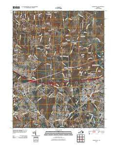
~ Gainesville VA topo map, 1:24000 scale, 7.5 X 7.5 Minute, Historical, 2010
Gainesville, Virginia, USGS topographic map dated 2010.
Includes geographic coordinates (latitude and longitude). This topographic map is suitable for hiking, camping, and exploring, or framing it as a wall map.
Printed on-demand using high resolution imagery, on heavy weight and acid free paper, or alternatively on a variety of synthetic materials.
Topos available on paper, Waterproof, Poly, or Tyvek. Usually shipping rolled, unless combined with other folded maps in one order.
- Product Number: USGS-5228855
- Free digital map download (high-resolution, GeoPDF): Gainesville, Virginia (file size: 21 MB)
- Map Size: please refer to the dimensions of the GeoPDF map above
- Weight (paper map): ca. 55 grams
- Map Type: POD USGS Topographic Map
- Map Series: US Topo
- Map Verison: Historical
- Cell ID: 70142
- Datum: North American Datum of 1983
- Map Projection: Transverse Mercator
- Map Cell Name: Gainesville
- Grid size: 7.5 X 7.5 Minute
- Date on map: 2010
- Map Scale: 1:24000
- Geographical region: Virginia, United States
Neighboring Maps:
All neighboring USGS topo maps are available for sale online at a variety of scales.
Spatial coverage:
Topo map Gainesville, Virginia, covers the geographical area associated the following places:
- Gypsum Hill Estates - Lakeview - Bull Run East - Rixlew - Breezy Knolls Estates - Rocky Run - Sudley Springs - Bataan Village - Crestwood Village - Snow Hill - Bull Run - Ashton Glen - Catharpin Farms - Carlyle Station - Westgate - Lawnvale Estates - Lakeview Estates - Linton Hall - Cedar Knolls - Catharpin Farms Estates - Twin Oaks - Gainesville - Wellington - Long Level Estates - Bannerwood - Hillwood Park Mobile Home Park - Stepney Plantation - Bushy Acres - Groveton - Old Field Estates - Sudley Mountain Estates - Tara Wood - Zouave Hills - Country Scene - Broad Run Village - New Market - Coverstone - Catharpin - Iron Gate
- Map Area ID: AREA38.87538.75-77.625-77.5
- Northwest corner Lat/Long code: USGSNW38.875-77.625
- Northeast corner Lat/Long code: USGSNE38.875-77.5
- Southwest corner Lat/Long code: USGSSW38.75-77.625
- Southeast corner Lat/Long code: USGSSE38.75-77.5
- Northern map edge Latitude: 38.875
- Southern map edge Latitude: 38.75
- Western map edge Longitude: -77.625
- Eastern map edge Longitude: -77.5


