
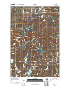
~ Frog Lake WI topo map, 1:24000 scale, 7.5 X 7.5 Minute, Historical, 2010
Frog Lake, Wisconsin, USGS topographic map dated 2010.
Includes geographic coordinates (latitude and longitude). This topographic map is suitable for hiking, camping, and exploring, or framing it as a wall map.
Printed on-demand using high resolution imagery, on heavy weight and acid free paper, or alternatively on a variety of synthetic materials.
Topos available on paper, Waterproof, Poly, or Tyvek. Usually shipping rolled, unless combined with other folded maps in one order.
- Product Number: USGS-5221988
- Free digital map download (high-resolution, GeoPDF): Frog Lake, Wisconsin (file size: 21 MB)
- Map Size: please refer to the dimensions of the GeoPDF map above
- Weight (paper map): ca. 55 grams
- Map Type: POD USGS Topographic Map
- Map Series: US Topo
- Map Verison: Historical
- Cell ID: 16501
- Datum: North American Datum of 1983
- Map Projection: Transverse Mercator
- Map Cell Name: Frog Lake
- Grid size: 7.5 X 7.5 Minute
- Date on map: 2010
- Map Scale: 1:24000
- Geographical region: Wisconsin, United States
Neighboring Maps:
All neighboring USGS topo maps are available for sale online at a variety of scales.
Spatial coverage:
Topo map Frog Lake, Wisconsin, covers the geographical area associated the following places:
- Forest Home Cemetery - Webb Lake Police Department - Warner Lake - Fivemile Lookout Tower - Meeker Run Lake - Prinel Lake - Spring Lake - Bass Lake - Oak Lake - Webb Lake Cemetery - Bradley Lake - Richart Lake - Fivemile Creek - Webb Lake 2WP466 Dam - McKenzie Creek - Lucerne Lake - Saginaw Lake - Stulen Lake - McDowel Bridge - Frog Lake - No Mans Lake - Webb Lake 18 - Pear Lake - Casey Creek - Webb Lake School - Lost Lake - Miniature Lake - Totagatic River - Lower Lost Lake 2WP936 Dam - Town of Webb Lake - Webb Creek
- Map Area ID: AREA46.12546-92.125-92
- Northwest corner Lat/Long code: USGSNW46.125-92.125
- Northeast corner Lat/Long code: USGSNE46.125-92
- Southwest corner Lat/Long code: USGSSW46-92.125
- Southeast corner Lat/Long code: USGSSE46-92
- Northern map edge Latitude: 46.125
- Southern map edge Latitude: 46
- Western map edge Longitude: -92.125
- Eastern map edge Longitude: -92


