
~ Eagle River West WI topo map, 1:24000 scale, 7.5 X 7.5 Minute, Historical, 2010
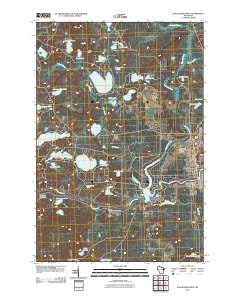
Eagle River West, Wisconsin, USGS topographic map dated 2010.
Includes geographic coordinates (latitude and longitude). This topographic map is suitable for hiking, camping, and exploring, or framing it as a wall map.
Printed on-demand using high resolution imagery, on heavy weight and acid free paper, or alternatively on a variety of synthetic materials.
Topos available on paper, Waterproof, Poly, or Tyvek. Usually shipping rolled, unless combined with other folded maps in one order.
- Product Number: USGS-5221970
- Free digital map download (high-resolution, GeoPDF): Eagle River West, Wisconsin (file size: 22 MB)
- Map Size: please refer to the dimensions of the GeoPDF map above
- Weight (paper map): ca. 55 grams
- Map Type: POD USGS Topographic Map
- Map Series: US Topo
- Map Verison: Historical
- Cell ID: 13276
- Datum: North American Datum of 1983
- Map Projection: Transverse Mercator
- Map Cell Name: Eagle River West
- Grid size: 7.5 X 7.5 Minute
- Date on map: 2010
- Map Scale: 1:24000
- Geographical region: Wisconsin, United States
Neighboring Maps:
All neighboring USGS topo maps are available for sale online at a variety of scales.
Spatial coverage:
Topo map Eagle River West, Wisconsin, covers the geographical area associated the following places:
- Otter Rapids 1905c483 Dam - Honeysuckle Lake - Sucker Creek - Northland Pines High School - Eagle River - Vilas County Courthouse - Bullfrog Lake - Otter Rapids Golf Course - McLeod Lake - Rice Lake - Rice Creek - Walter E Olson Memorial Library - Seneca Lake - Frost Lake - Lotus Lake - Perch Lake - Range Line Lake - Watersmeet Lake 533 - Muskellunge School (historical) - Deep Lake - Eagle River Memorial Hospital - Pickerel Creek - Tellefson Lake - Mud Lake - Little Pine Lake - Sunset Lake - Mud Creek - Boot Creek - Northland Pines Middle School - Boot Lake School (historical) - Brazell Creek - Town of Cloverland - Nelson Lake - Otter Rapids Dam - Boot Lake - Snipe Lake - Bohemian School (historical) - Vilas County Jail - Cooks Lake - Watersmeet Lake - Lake Mary - Adams Lake - Crocker School (historical) - Mud Minnow Lake - Tepee Lake - Travel Care International - Northland Pines Elementary School Eagle River - Chickaree Lake - Perch Lake School (historical) - Croker Lake - City of Eagle River - Brazell Lake - Eagle River Union Airport - Lake Aidenn - Eagle River Village Hall - Vilas County Sheriff's Office
- Map Area ID: AREA4645.875-89.375-89.25
- Northwest corner Lat/Long code: USGSNW46-89.375
- Northeast corner Lat/Long code: USGSNE46-89.25
- Southwest corner Lat/Long code: USGSSW45.875-89.375
- Southeast corner Lat/Long code: USGSSE45.875-89.25
- Northern map edge Latitude: 46
- Southern map edge Latitude: 45.875
- Western map edge Longitude: -89.375
- Eastern map edge Longitude: -89.25


