
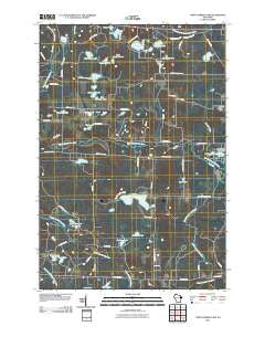
~ Town Corner Lake WI topo map, 1:24000 scale, 7.5 X 7.5 Minute, Historical, 2010
Town Corner Lake, Wisconsin, USGS topographic map dated 2010.
Includes geographic coordinates (latitude and longitude). This topographic map is suitable for hiking, camping, and exploring, or framing it as a wall map.
Printed on-demand using high resolution imagery, on heavy weight and acid free paper, or alternatively on a variety of synthetic materials.
Topos available on paper, Waterproof, Poly, or Tyvek. Usually shipping rolled, unless combined with other folded maps in one order.
- Product Number: USGS-5221900
- Free digital map download (high-resolution, GeoPDF): Town Corner Lake, Wisconsin (file size: 18 MB)
- Map Size: please refer to the dimensions of the GeoPDF map above
- Weight (paper map): ca. 55 grams
- Map Type: POD USGS Topographic Map
- Map Series: US Topo
- Map Verison: Historical
- Cell ID: 45492
- Datum: North American Datum of 1983
- Map Projection: Transverse Mercator
- Map Cell Name: Town Corner Lake
- Grid size: 7.5 X 7.5 Minute
- Date on map: 2010
- Map Scale: 1:24000
- Geographical region: Wisconsin, United States
Neighboring Maps:
All neighboring USGS topo maps are available for sale online at a variety of scales.
Spatial coverage:
Topo map Town Corner Lake, Wisconsin, covers the geographical area associated the following places:
- Beecher Lake 3WR1552 Dam - Redman Lake - Beecher Lake - Merriman Lake - Chipmunk Rapids - Thoeming Lake - Cole Creek - Lillie Lake - Bull Falls - Elm Flats Lake - Town Corner Lake - Town Corner State Wildlife Management Area - Smeester School (historical) - Monson Pond - Lily Lake - South Branch Pike River - Coons School (historical) - Back Lake - Camp Lake - Merriman School (historical) - Red Roof Airport - Phillips Lake - Lundgren Lake - Upper Lake - Northland International University - Minnie Lake - Wiggins Lake - Barnes Lake - North Branch Pike River - Cole Lake - West Pickerel Pond - Whiskey Creek - Williams Lake - Barr Lake - McDonald Lake - Christian Lake - Dolan Lake - Woempner Lake - East Pickerel Pond - Beecher Church - Lindquist Lake - Pike Ridge School (historical) - West Twin Lake - Town Corner Creek - East Twin Lake - Young Lake
- Map Area ID: AREA45.62545.5-88.125-88
- Northwest corner Lat/Long code: USGSNW45.625-88.125
- Northeast corner Lat/Long code: USGSNE45.625-88
- Southwest corner Lat/Long code: USGSSW45.5-88.125
- Southeast corner Lat/Long code: USGSSE45.5-88
- Northern map edge Latitude: 45.625
- Southern map edge Latitude: 45.5
- Western map edge Longitude: -88.125
- Eastern map edge Longitude: -88


