
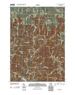
~ Potato Hill WI topo map, 1:24000 scale, 7.5 X 7.5 Minute, Historical, 2010
Potato Hill, Wisconsin, USGS topographic map dated 2010.
Includes geographic coordinates (latitude and longitude). This topographic map is suitable for hiking, camping, and exploring, or framing it as a wall map.
Printed on-demand using high resolution imagery, on heavy weight and acid free paper, or alternatively on a variety of synthetic materials.
Topos available on paper, Waterproof, Poly, or Tyvek. Usually shipping rolled, unless combined with other folded maps in one order.
- Product Number: USGS-5221668
- Free digital map download (high-resolution, GeoPDF): Potato Hill, Wisconsin (file size: 19 MB)
- Map Size: please refer to the dimensions of the GeoPDF map above
- Weight (paper map): ca. 55 grams
- Map Type: POD USGS Topographic Map
- Map Series: US Topo
- Map Verison: Historical
- Cell ID: 36164
- Datum: North American Datum of 1983
- Map Projection: Transverse Mercator
- Map Cell Name: Potato Hill
- Grid size: 7.5 X 7.5 Minute
- Date on map: 2010
- Map Scale: 1:24000
- Geographical region: Wisconsin, United States
Neighboring Maps:
All neighboring USGS topo maps are available for sale online at a variety of scales.
Spatial coverage:
Topo map Potato Hill, Wisconsin, covers the geographical area associated the following places:
- Spring Creek - Borge G5080 Dam - Plainview School (historical) - Stewart Creek - Saint Paul Church - Bass Hollow State Natural Area - Evergreen Cemetery - Pollard Rock - Pawlisch E6039 Dam - Barney School (historical) - Saint Paul Cemetery - 0.58 Reservoir - Saint Paul School (historical) - 0.48 Reservoir - Darrow School (historical) - Wafle School (historical) - Bass Hollow - Potato Hill - Big Creek Cemetery - Bass Hollow County Recreation Area - Sheep Pasture Bluff School (historical) - Rock Valley School (historical) - Barney Cemetery - Cattail Valley School (historical) - Town of Seven Mile Creek
- Map Area ID: AREA43.7543.625-90.125-90
- Northwest corner Lat/Long code: USGSNW43.75-90.125
- Northeast corner Lat/Long code: USGSNE43.75-90
- Southwest corner Lat/Long code: USGSSW43.625-90.125
- Southeast corner Lat/Long code: USGSSE43.625-90
- Northern map edge Latitude: 43.75
- Southern map edge Latitude: 43.625
- Western map edge Longitude: -90.125
- Eastern map edge Longitude: -90


