
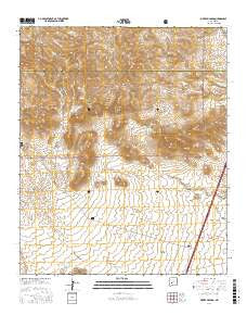
~ Sierra Fijardo NM topo map, 1:24000 scale, 7.5 X 7.5 Minute, 2017
Sierra Fijardo, New Mexico, USGS topographic map dated 2017.
Includes geographic coordinates (latitude and longitude). This topographic map is suitable for hiking, camping, and exploring, or framing it as a wall map.
Printed on-demand using high resolution imagery, on heavy weight and acid free paper, or alternatively on a variety of synthetic materials.
Topos available on paper, Waterproof, Poly, or Tyvek. Usually shipping rolled, unless combined with other folded maps in one order.
- Product Number: USGS-8660810
- Free digital map download (high-resolution, GeoPDF): Sierra Fijardo, New Mexico (file size: 27 MB)
- Map Size: please refer to the dimensions of the GeoPDF map above
- Weight (paper map): ca. 55 grams
- Map Type: POD USGS Topographic Map
- Map Series: US Topo
- Map Verison: Current
- Cell ID: 41288
- Datum: North American Datum of 1983
- Map Projection: Transverse Mercator
- Map Cell Name: Sierra Fijardo
- Grid size: 7.5 X 7.5 Minute
- Date on map: 2017
- Map Scale: 1:24000
- Geographical region: New Mexico, United States
Neighboring Maps:
All neighboring USGS topo maps are available for sale online at a variety of scales.
Spatial coverage:
Topo map Sierra Fijardo, New Mexico, covers the geographical area associated the following places:
- Peñasco Peak - Deer Springs - Los Pillares Well - Eagles Roost - Peñasco Spring - Los Tinajas - Deer Springs Canyon - Ducknest Tank - H Bierner Number 2 Reservoir - Peñasco Canyon - Whiskey Hill - Street Canyon - Lighting Ridge - Flying X Water Well - Los Pillares - Marcus Tank - Rattlesnake Hill - Flying X Ranch - Flying X 2 Water Well - Street Well - Aragon Draw - Sierras Mediano - Sierra Fijardo
- Map Area ID: AREA33.533.375-107.375-107.25
- Northwest corner Lat/Long code: USGSNW33.5-107.375
- Northeast corner Lat/Long code: USGSNE33.5-107.25
- Southwest corner Lat/Long code: USGSSW33.375-107.375
- Southeast corner Lat/Long code: USGSSE33.375-107.25
- Northern map edge Latitude: 33.5
- Southern map edge Latitude: 33.375
- Western map edge Longitude: -107.375
- Eastern map edge Longitude: -107.25


