
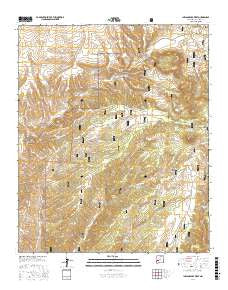
~ Indian Peaks West NM topo map, 1:24000 scale, 7.5 X 7.5 Minute, 2017
Indian Peaks West, New Mexico, USGS topographic map dated 2017.
Includes geographic coordinates (latitude and longitude). This topographic map is suitable for hiking, camping, and exploring, or framing it as a wall map.
Printed on-demand using high resolution imagery, on heavy weight and acid free paper, or alternatively on a variety of synthetic materials.
Topos available on paper, Waterproof, Poly, or Tyvek. Usually shipping rolled, unless combined with other folded maps in one order.
- Product Number: USGS-8660652
- Free digital map download (high-resolution, GeoPDF): Indian Peaks West, New Mexico (file size: 32 MB)
- Map Size: please refer to the dimensions of the GeoPDF map above
- Weight (paper map): ca. 55 grams
- Map Type: POD USGS Topographic Map
- Map Series: US Topo
- Map Verison: Current
- Cell ID: 21858
- Datum: North American Datum of 1983
- Map Projection: Transverse Mercator
- Map Cell Name: Indian Peaks West
- Grid size: 7.5 X 7.5 Minute
- Date on map: 2017
- Map Scale: 1:24000
- Geographical region: New Mexico, United States
Neighboring Maps:
All neighboring USGS topo maps are available for sale online at a variety of scales.
Spatial coverage:
Topo map Indian Peaks West, New Mexico, covers the geographical area associated the following places:
- Long Day Tank - West Tank - Upper Spring Tank - Railroad Tank - Valley Tank - Wall Tank - Whiskey Canyon - Homestead Tank - West Central Tank - Lost Chance Canyon - Mule Canyon Well - Line Gap Tank - Bear Canyon Tank - Garcia Tank - North Star Tank - Juan Tank - Last Chance Canyon - Indian Spring Tank - Cottonwood Spring - Lower Mule Tank - Chaves Tank - Upper Mule Tank - Mule Tank - Lower North Star Tank - Mesa Tank - Bear Springs - Kennedy Tank - Garcia Windmill - Garcia Trick Tank - Middle North Star Tank - Gravel Pit Tank - Lost Chance Tank - Whiskey Tank - Indian Peaks - Last Chance Tank - Railroad Canyon Windmill
- Map Area ID: AREA33.62533.5-108.125-108
- Northwest corner Lat/Long code: USGSNW33.625-108.125
- Northeast corner Lat/Long code: USGSNE33.625-108
- Southwest corner Lat/Long code: USGSSW33.5-108.125
- Southeast corner Lat/Long code: USGSSE33.5-108
- Northern map edge Latitude: 33.625
- Southern map edge Latitude: 33.5
- Western map edge Longitude: -108.125
- Eastern map edge Longitude: -108


