
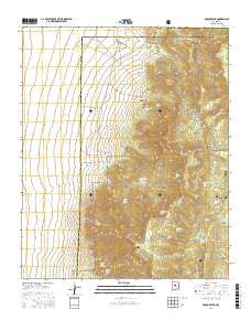
~ Bosque Peak NM topo map, 1:24000 scale, 7.5 X 7.5 Minute, 2017
Bosque Peak, New Mexico, USGS topographic map dated 2017.
Includes geographic coordinates (latitude and longitude). This topographic map is suitable for hiking, camping, and exploring, or framing it as a wall map.
Printed on-demand using high resolution imagery, on heavy weight and acid free paper, or alternatively on a variety of synthetic materials.
Topos available on paper, Waterproof, Poly, or Tyvek. Usually shipping rolled, unless combined with other folded maps in one order.
- Product Number: USGS-8651634
- Free digital map download (high-resolution, GeoPDF): Bosque Peak, New Mexico (file size: 27 MB)
- Map Size: please refer to the dimensions of the GeoPDF map above
- Weight (paper map): ca. 55 grams
- Map Type: POD USGS Topographic Map
- Map Series: US Topo
- Map Verison: Current
- Cell ID: 4922
- Datum: North American Datum of 1983
- Map Projection: Transverse Mercator
- Map Cell Name: Bosque Peak
- Grid size: 7.5 X 7.5 Minute
- Date on map: 2017
- Map Scale: 1:24000
- Geographical region: New Mexico, United States
Neighboring Maps:
All neighboring USGS topo maps are available for sale online at a variety of scales.
Spatial coverage:
Topo map Bosque Peak, New Mexico, covers the geographical area associated the following places:
- Guadalupe Peak - Tilio Spring - Cañon de los Moyos - White Rock Canyon - Yellowstone Trail - Encino Canyon - 10029 Water Well - Sand Canyon - Cave Spring - Bosque Trailhead - Fourth of July Spring - Albuquerque Trail Spring - Cerro Blanco Trailhead - Yellowstone Spring - Mosca Trail - Ojito Los Burros Spring - Fourth of July Campground - Diablo Spring - Piedra Lisa Spring - Lo De Padilla - Los Vayas Spring - Vigil Trail - Escondido Spring - Albuquerque Trail - 10241 Water Well - Cerro Blanco - Garcia Canyon - Canon de los Seis - Big Spring - Upper Encino Spring - North Bosque Peak - Lolito Spring - Diablo Canyon - Bosque Trail - Lower Encino Spring - Pitch Spring - Upper Fourth of July Spring - Cerro Blanco Trail - Bosque Peak - Ojito Trail - Garcia Spring - Ojito Canyon - White Rock Spring - Mosca Peak - Bosque Peak Cemetery
- Map Area ID: AREA34.87534.75-106.5-106.375
- Northwest corner Lat/Long code: USGSNW34.875-106.5
- Northeast corner Lat/Long code: USGSNE34.875-106.375
- Southwest corner Lat/Long code: USGSSW34.75-106.5
- Southeast corner Lat/Long code: USGSSE34.75-106.375
- Northern map edge Latitude: 34.875
- Southern map edge Latitude: 34.75
- Western map edge Longitude: -106.5
- Eastern map edge Longitude: -106.375


