
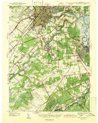
~ New Brunswick NJ topo map, 1:31680 scale, 7.5 X 7.5 Minute, Historical, 1942
New Brunswick, New Jersey, USGS topographic map dated 1942.
Includes geographic coordinates (latitude and longitude). This topographic map is suitable for hiking, camping, and exploring, or framing it as a wall map.
Printed on-demand using high resolution imagery, on heavy weight and acid free paper, or alternatively on a variety of synthetic materials.
Topos available on paper, Waterproof, Poly, or Tyvek. Usually shipping rolled, unless combined with other folded maps in one order.
- Product Number: USGS-8518725
- Free digital map download (high-resolution, GeoPDF): New Brunswick, New Jersey (file size: 8 MB)
- Map Size: please refer to the dimensions of the GeoPDF map above
- Weight (paper map): ca. 55 grams
- Map Type: POD USGS Topographic Map
- Map Series: HTMC
- Map Verison: Historical
- Cell ID: 31666
- Scan ID: 255055
- Woodland Tint: Yes
- Survey Year: 1939
- Datum: NAD27
- Map Projection: Polyconic
- Preliminary map: Yes
- Map published by United States Geological Survey
- Map Language: English
- Scanner Resolution: 600 dpi
- Map Cell Name: New Brunswick
- Grid size: 7.5 X 7.5 Minute
- Date on map: 1942
- Map Scale: 1:31680
- Geographical region: New Jersey, United States
Neighboring Maps:
All neighboring USGS topo maps are available for sale online at a variety of scales.
Spatial coverage:
Topo map New Brunswick, New Jersey, covers the geographical area associated the following places:
- Maple Meade - Washington Heights - Westons Mills - Voorhees - Tanners Corners - Raritan Gardens - Martins Landing - Spotswood - Helmetta - Adams - South River - Red Lion - Patricks Corners - Orchard Heights - Newton Heights - Spotswood Manor - Lawrence Brook Manor - Dunhams Corners - Outcalt - Berdines Corners - Brookview - Feaster Park - Somerset - Rutgers - Herberts - Fairview Knolls - Piscataway - Lincoln Park - Milltown - Greensand - Jamesburg Park - Edgebrook - Paulas Corners - Fresh Ponds - Farrington Lake Heights - New Brunswick - Cottageville - Gillilandtown - Highland Park - East Brunswick
- Map Area ID: AREA40.540.375-74.5-74.375
- Northwest corner Lat/Long code: USGSNW40.5-74.5
- Northeast corner Lat/Long code: USGSNE40.5-74.375
- Southwest corner Lat/Long code: USGSSW40.375-74.5
- Southeast corner Lat/Long code: USGSSE40.375-74.375
- Northern map edge Latitude: 40.5
- Southern map edge Latitude: 40.375
- Western map edge Longitude: -74.5
- Eastern map edge Longitude: -74.375


