
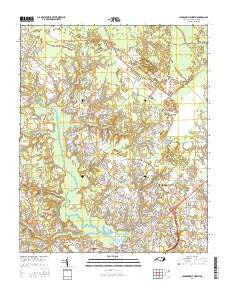
~ Jacksonville North NC topo map, 1:24000 scale, 7.5 X 7.5 Minute, 2016
Jacksonville North, North Carolina, USGS topographic map dated 2016.
Includes geographic coordinates (latitude and longitude). This topographic map is suitable for hiking, camping, and exploring, or framing it as a wall map.
Printed on-demand using high resolution imagery, on heavy weight and acid free paper, or alternatively on a variety of synthetic materials.
Topos available on paper, Waterproof, Poly, or Tyvek. Usually shipping rolled, unless combined with other folded maps in one order.
- Product Number: USGS-8139737
- Free digital map download (high-resolution, GeoPDF): Jacksonville North, North Carolina (file size: 25 MB)
- Map Size: please refer to the dimensions of the GeoPDF map above
- Weight (paper map): ca. 55 grams
- Map Type: POD USGS Topographic Map
- Map Series: US Topo
- Map Verison: Current
- Cell ID: 22329
- Datum: North American Datum of 1983
- Map Projection: Transverse Mercator
- Map Cell Name: Jacksonville North
- Grid size: 7.5 X 7.5 Minute
- Date on map: 2016
- Map Scale: 1:24000
- Geographical region: North Carolina, United States
Neighboring Maps:
All neighboring USGS topo maps are available for sale online at a variety of scales.
Spatial coverage:
Topo map Jacksonville North, North Carolina, covers the geographical area associated the following places:
- Jacksonville - Town Ranch Heights - Foxhorn Village - Mill Pond Village - McArthur Estates - Deerfield - Raintree - Cedar Creek - Twin Pines Mobile Home Park - Sunset Acres - Mill Pond Meadows - Summersill Estates - Warrens Trailer Park - Hawkside - Houston Mobile Home Park - Faries Trailer Park - Sherwood Forest - Half Moon Heights - Brynn Marr - Northwoods Park - Rainbow Acres Mobile Home Park - Onslow Gardens - Oak Grove - Aldersgate - Willow Woods - Half Moon - Bell Fork - Long Acres - Indian Springs - Hillcrest Mobile Home Subdivision - Greenbriar - Branchwood - Greencrest - Morton Manor - Tar Landing - Lakewood - Hickory Hills West Trailer Park - Pine Forest Acres - Shamrock Village - Greystone - Acorn Forest - Lauradale - Forest Grove - Westgate - Gum Branch - Stillwood - Oakhurst River Estates - Brookview Estates - Edgewood Park - Houston Heights - College Park - New River - Cardinal Village - Triangle Trailer Park - Bell Fork Homes
- Map Area ID: AREA34.87534.75-77.5-77.375
- Northwest corner Lat/Long code: USGSNW34.875-77.5
- Northeast corner Lat/Long code: USGSNE34.875-77.375
- Southwest corner Lat/Long code: USGSSW34.75-77.5
- Southeast corner Lat/Long code: USGSSE34.75-77.375
- Northern map edge Latitude: 34.875
- Southern map edge Latitude: 34.75
- Western map edge Longitude: -77.5
- Eastern map edge Longitude: -77.375


