
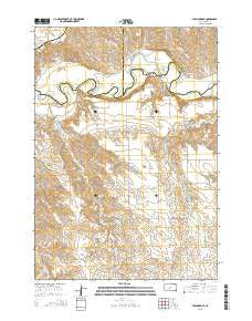
~ Stamford SE SD topo map, 1:24000 scale, 7.5 X 7.5 Minute, 2015
Stamford SE, South Dakota, USGS topographic map dated 2015.
Includes geographic coordinates (latitude and longitude). This topographic map is suitable for hiking, camping, and exploring, or framing it as a wall map.
Printed on-demand using high resolution imagery, on heavy weight and acid free paper, or alternatively on a variety of synthetic materials.
Topos available on paper, Waterproof, Poly, or Tyvek. Usually shipping rolled, unless combined with other folded maps in one order.
- Product Number: USGS-8015506
- Free digital map download (high-resolution, GeoPDF): Stamford SE, South Dakota (file size: 22 MB)
- Map Size: please refer to the dimensions of the GeoPDF map above
- Weight (paper map): ca. 55 grams
- Map Type: POD USGS Topographic Map
- Map Series: US Topo
- Map Verison: Current
- Cell ID: 42845
- Datum: North American Datum of 1983
- Map Projection: Transverse Mercator
- Map Cell Name: Stamford SE
- Grid size: 7.5 X 7.5 Minute
- Date on map: 2015
- Map Scale: 1:24000
- Geographical region: South Dakota, United States
Neighboring Maps:
All neighboring USGS topo maps are available for sale online at a variety of scales.
Spatial coverage:
Topo map Stamford SE, South Dakota, covers the geographical area associated the following places:
- Iwan O M Number 3 Dam - Perault Ranch - Iwan O M Number 1 Dam - White Horse Springs - Schamber (historical) - Township of Red Fish - Vohr Ranch - Bear Heels Ranch - Good Road Cemetery - Harmony School - Saint Paul German Lutheran Cemetery - Runs Close Creek - Perault Number 4 Dam - Hathaway Ranch - Daum Brothers Number 1 Dam - Perault Number 7 Dam - Iwan Number 4 Dam - Iwan Ranch - Perault Number 5 Dam - Perault Number 6 Dam - Perault Number 1 Dam
- Map Area ID: AREA43.87543.75-101.125-101
- Northwest corner Lat/Long code: USGSNW43.875-101.125
- Northeast corner Lat/Long code: USGSNE43.875-101
- Southwest corner Lat/Long code: USGSSW43.75-101.125
- Southeast corner Lat/Long code: USGSSE43.75-101
- Northern map edge Latitude: 43.875
- Southern map edge Latitude: 43.75
- Western map edge Longitude: -101.125
- Eastern map edge Longitude: -101


