
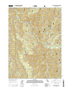
~ Canthook Mountain CA topo map, 1:24000 scale, 7.5 X 7.5 Minute, 2015
Canthook Mountain, California, USGS topographic map dated 2015.
Includes geographic coordinates (latitude and longitude). This topographic map is suitable for hiking, camping, and exploring, or framing it as a wall map.
Printed on-demand using high resolution imagery, on heavy weight and acid free paper, or alternatively on a variety of synthetic materials.
Topos available on paper, Waterproof, Poly, or Tyvek. Usually shipping rolled, unless combined with other folded maps in one order.
- Product Number: USGS-7976661
- Free digital map download (high-resolution, GeoPDF): Canthook Mountain, California (file size: 26 MB)
- Map Size: please refer to the dimensions of the GeoPDF map above
- Weight (paper map): ca. 55 grams
- Map Type: POD USGS Topographic Map
- Map Series: US Topo
- Map Verison: Current
- Cell ID: 7099
- Datum: North American Datum of 1983
- Map Projection: Transverse Mercator
- Map Cell Name: Canthook Mountain
- Grid size: 7.5 X 7.5 Minute
- Date on map: 2015
- Map Scale: 1:24000
- Geographical region: California, United States
Neighboring Maps:
All neighboring USGS topo maps are available for sale online at a variety of scales.
Spatial coverage:
Topo map Canthook Mountain, California, covers the geographical area associated the following places:
- Pigeon Roost - Jones Creek - Rattlesnake Trail - Stevens Ranch - Canthook Mountain - Little Rattlesnake Mountain - Hurdygurdy Bridge - Blackhawk Creek - Knapp Estate - Paradise Flat - Goose Creek - Hardin Mountain - Soldier Well - Rock Creek - Rattlesnake Flat - Little Rattlesnake Lookout (historical) - Big Flat Forest Service Station - Chrome Mine - China Mine - Del Norte County - Cable Crossing - Dry Lake - Paradise Ranch (historical) - Deer Creek - Canthook Creek - Big Flat - Wilson Ranch - Rock Creek Camp - Boulder Creek - Horse Flat - Rattlesnake Mountain - Melson Ranch - Gordon Creek - Indian Bar - Haines Flat - Pigeon Roost Spring - Paradise Trail - Rattlesnake Lake - Alma Ranch - Hurdygurdy Creek - Big Flat Campground - Boulder Ridge - Haydens Gulch - Mud Spring - Canthook Prairie
- Map Area ID: AREA41.7541.625-124-123.875
- Northwest corner Lat/Long code: USGSNW41.75-124
- Northeast corner Lat/Long code: USGSNE41.75-123.875
- Southwest corner Lat/Long code: USGSSW41.625-124
- Southeast corner Lat/Long code: USGSSE41.625-123.875
- Northern map edge Latitude: 41.75
- Southern map edge Latitude: 41.625
- Western map edge Longitude: -124
- Eastern map edge Longitude: -123.875


