
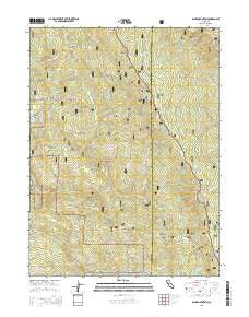
~ Blake Mountain CA topo map, 1:24000 scale, 7.5 X 7.5 Minute, 2015
Blake Mountain, California, USGS topographic map dated 2015.
Includes geographic coordinates (latitude and longitude). This topographic map is suitable for hiking, camping, and exploring, or framing it as a wall map.
Printed on-demand using high resolution imagery, on heavy weight and acid free paper, or alternatively on a variety of synthetic materials.
Topos available on paper, Waterproof, Poly, or Tyvek. Usually shipping rolled, unless combined with other folded maps in one order.
- Product Number: USGS-7975877
- Free digital map download (high-resolution, GeoPDF): Blake Mountain, California (file size: 27 MB)
- Map Size: please refer to the dimensions of the GeoPDF map above
- Weight (paper map): ca. 55 grams
- Map Type: POD USGS Topographic Map
- Map Series: US Topo
- Map Verison: Current
- Cell ID: 4316
- Datum: North American Datum of 1983
- Map Projection: Transverse Mercator
- Map Cell Name: Blake Mountain
- Grid size: 7.5 X 7.5 Minute
- Date on map: 2015
- Map Scale: 1:24000
- Geographical region: California, United States
Neighboring Maps:
All neighboring USGS topo maps are available for sale online at a variety of scales.
Spatial coverage:
Topo map Blake Mountain, California, covers the geographical area associated the following places:
- Guy Lake - Becker Ridge - Pilot Creek - Holm Ridge - Cold Spring - Mud Spring - Mad River Trail - Becker Racetrack - Skull Camp - Henry Ridge - Cold Springs - County Line Trail - Bailey Ridge - Happy Jack Spring - Severin Openings - Murry Place - Eightmile Ridge - Eightmile Lookout - Holm Buttes - Dorr Ridge - Pistol Spring - Blake Spring Campground - Blake Mountain - East Creek - Torrey Crossing - Rattlesnake Creek - Doe Rock - Edgar Spring - Poison Spring - Saddleback Opening - Maple Spring - Anderson Ford - Al Hazen Ridge - Carson Opening - Becker Cabin - Torrey Ridge - Bryant Ridge - Packy Spring - Blake Trail - Doe Spring - Torrey Corrals - Skull Camp Trail - Owl Creek - Day Opening
- Map Area ID: AREA40.62540.5-123.625-123.5
- Northwest corner Lat/Long code: USGSNW40.625-123.625
- Northeast corner Lat/Long code: USGSNE40.625-123.5
- Southwest corner Lat/Long code: USGSSW40.5-123.625
- Southeast corner Lat/Long code: USGSSE40.5-123.5
- Northern map edge Latitude: 40.625
- Southern map edge Latitude: 40.5
- Western map edge Longitude: -123.625
- Eastern map edge Longitude: -123.5


