
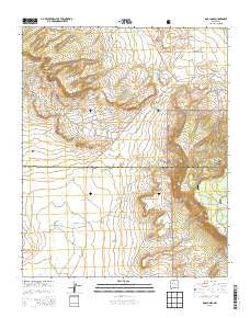
~ Dos Lomas NM topo map, 1:24000 scale, 7.5 X 7.5 Minute, Current, 2013
Dos Lomas, New Mexico, USGS topographic map dated 2013.
Includes geographic coordinates (latitude and longitude). This topographic map is suitable for hiking, camping, and exploring, or framing it as a wall map.
Printed on-demand using high resolution imagery, on heavy weight and acid free paper, or alternatively on a variety of synthetic materials.
Topos available on paper, Waterproof, Poly, or Tyvek. Usually shipping rolled, unless combined with other folded maps in one order.
- Product Number: USGS-7792092
- Free digital map download (high-resolution, GeoPDF): Dos Lomas, New Mexico (file size: 32 MB)
- Map Size: please refer to the dimensions of the GeoPDF map above
- Weight (paper map): ca. 55 grams
- Map Type: POD USGS Topographic Map
- Map Series: US Topo
- Map Verison: Current
- Cell ID: 12603
- Datum: North American Datum of 1983
- Map Projection: Transverse Mercator
- Map Cell Name: Dos Lomas
- Grid size: 7.5 X 7.5 Minute
- Date on map: 2013
- Map Scale: 1:24000
- Geographical region: New Mexico, United States
Neighboring Maps:
All neighboring USGS topo maps are available for sale online at a variety of scales.
Spatial coverage:
Topo map Dos Lomas, New Mexico, covers the geographical area associated the following places:
- 10069 Water Well - Roundy Mine - Anaconda Section Nine Mine - San Mateo Creek - Last Chance Mine - Western Section Twenty One Mine - Dalco Mine - Faith Mine - Zia Mines - Farris Mine - Hope Mine - Double Jerry - Marquez Mine - 10010 Water Well - Dos Lomas - Flea Mine - Black Hawk Mine - Gossett - Arroyo del Puerto - Hanosh Mine - Poison Canyon - UDC-5 - Marcus Mine - 10011 Water Well - Mesa Top Mine - Golden P Roundy Mine - UDC-1 - Grants Perlite Mine - Christmas Day Group - Poison Canyon Mine - Flat Top Mine - Kerr McGee Pit 31-13-9 - Round Butte - Morrow Mine - Todilto Mine Number Two - Three Jacks Mine - Malpais - June Mine - Rancho Del Puerto - Mesa Top Seven - Holly - Uran Deposit - Roundy Ranch - Vallejo Mine - Barbara J Number 1 Mine - Flea Doris Extension - Isabella - Gay Eagle Mine - Flat Mesa - Westvaco Mine - Taffy - Zia - Hogan Mine - El Puertecito
- Map Area ID: AREA35.37535.25-107.875-107.75
- Northwest corner Lat/Long code: USGSNW35.375-107.875
- Northeast corner Lat/Long code: USGSNE35.375-107.75
- Southwest corner Lat/Long code: USGSSW35.25-107.875
- Southeast corner Lat/Long code: USGSSE35.25-107.75
- Northern map edge Latitude: 35.375
- Southern map edge Latitude: 35.25
- Western map edge Longitude: -107.875
- Eastern map edge Longitude: -107.75


