
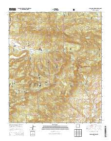
~ Dillon Mountain NM topo map, 1:24000 scale, 7.5 X 7.5 Minute, Historical, 2013
Dillon Mountain, New Mexico, USGS topographic map dated 2013.
Includes geographic coordinates (latitude and longitude). This topographic map is suitable for hiking, camping, and exploring, or framing it as a wall map.
Printed on-demand using high resolution imagery, on heavy weight and acid free paper, or alternatively on a variety of synthetic materials.
Topos available on paper, Waterproof, Poly, or Tyvek. Usually shipping rolled, unless combined with other folded maps in one order.
- Product Number: USGS-7792070
- Free digital map download (high-resolution, GeoPDF): Dillon Mountain, New Mexico (file size: 41 MB)
- Map Size: please refer to the dimensions of the GeoPDF map above
- Weight (paper map): ca. 55 grams
- Map Type: POD USGS Topographic Map
- Map Series: US Topo
- Map Verison: Historical
- Cell ID: 12285
- Datum: North American Datum of 1983
- Map Projection: Transverse Mercator
- Map Cell Name: Dillon Mountain
- Grid size: 7.5 X 7.5 Minute
- Date on map: 2013
- Map Scale: 1:24000
- Geographical region: New Mexico, United States
Neighboring Maps:
All neighboring USGS topo maps are available for sale online at a variety of scales.
Spatial coverage:
Topo map Dillon Mountain, New Mexico, covers the geographical area associated the following places:
- Lost Spring Canyon - Juniper Ridge Tank - Devil Canyon - Howell Canyon - Centerfire Creek - Strawberry Canyon - Pine Canyon - Heifer Basin Tank - Joshua Tank - Howell Tank - Seep Spring Canyon - Lion Spring - Geronimo Canyon - Spur Trail Draw - Pine Tank - Frisco Hot Spring - Grapevine Canyon - Devil Tank Number One - Dillon Mountain - Warm Springs Canyon - Devil Tank Number Two - Monument Mountain - Curio Canyon - Mess Box Spring - Lonnie Tank - Lily Patch Tank - Bill Lewis Spring - Toriette Lakes - Miller Ranch - The Box - Devil Spring - Crass V Tank - Bill Lewis Mesa - Shelby Tank - H Bar V Saddle - Curio Tank - Upper Frisco Hot Springs - McCarty Flat - Hudson Spring - Hog Canyon - Strawberry Tank - Devil Tank - Indian Spring - Juniper Ridge - Big Spring - Liedman Tank - South Mountain - The Box - Joshua Canyon - Mess Box Mesa - Skunk Spring
- Map Area ID: AREA33.87533.75-108.875-108.75
- Northwest corner Lat/Long code: USGSNW33.875-108.875
- Northeast corner Lat/Long code: USGSNE33.875-108.75
- Southwest corner Lat/Long code: USGSSW33.75-108.875
- Southeast corner Lat/Long code: USGSSE33.75-108.75
- Northern map edge Latitude: 33.875
- Southern map edge Latitude: 33.75
- Western map edge Longitude: -108.875
- Eastern map edge Longitude: -108.75


