
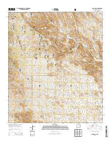
~ C Bar Ranch NM topo map, 1:24000 scale, 7.5 X 7.5 Minute, Historical, 2013
C Bar Ranch, New Mexico, USGS topographic map dated 2013.
Includes geographic coordinates (latitude and longitude). This topographic map is suitable for hiking, camping, and exploring, or framing it as a wall map.
Printed on-demand using high resolution imagery, on heavy weight and acid free paper, or alternatively on a variety of synthetic materials.
Topos available on paper, Waterproof, Poly, or Tyvek. Usually shipping rolled, unless combined with other folded maps in one order.
- Product Number: USGS-7791047
- Free digital map download (high-resolution, GeoPDF): C Bar Ranch, New Mexico (file size: 38 MB)
- Map Size: please refer to the dimensions of the GeoPDF map above
- Weight (paper map): ca. 55 grams
- Map Type: POD USGS Topographic Map
- Map Series: US Topo
- Map Verison: Historical
- Cell ID: 6565
- Datum: North American Datum of 1983
- Map Projection: Transverse Mercator
- Map Cell Name: C Bar Ranch
- Grid size: 7.5 X 7.5 Minute
- Date on map: 2013
- Map Scale: 1:24000
- Geographical region: New Mexico, United States
Neighboring Maps:
All neighboring USGS topo maps are available for sale online at a variety of scales.
Spatial coverage:
Topo map C Bar Ranch, New Mexico, covers the geographical area associated the following places:
- Walker Tank - Mine Tank - Blacktail Tank - Whitetail Tank - Whitetail Canyon - Double Strike Deposit - Smith Windmill - Whitetop Well - Bounds Ranch - Whitetop Hill - Seep Tank - Barrow Windmill - Big Laddie Tank - Little Windmill - Lonesome Tank - C Bar Water Well - Little Laddie Tank - American Deposit - Jones Windmill - Gunn Tank - Whitetop Windmill - Gold Hill Tank - C Bar Ranch - Kramer Windmill - Juniper Spring Tank - Little Tank - Big Tank - Myers Canyon - Burro Cienga Tank - Prevost Windmill - Hookedy Tank - Picnic Canyon - Glaze Well - Taylor Windmills - Glaze Ranch - Werney Flat - Taylor Canyon - Hall Draw - Jones Ranch - Silver City Draw - Walking X Canyon - Glaze Reservoir - Willis Windmill - C Bar Canyon
- Map Area ID: AREA32.532.375-108.5-108.375
- Northwest corner Lat/Long code: USGSNW32.5-108.5
- Northeast corner Lat/Long code: USGSNE32.5-108.375
- Southwest corner Lat/Long code: USGSSW32.375-108.5
- Southeast corner Lat/Long code: USGSSE32.375-108.375
- Northern map edge Latitude: 32.5
- Southern map edge Latitude: 32.375
- Western map edge Longitude: -108.5
- Eastern map edge Longitude: -108.375


