
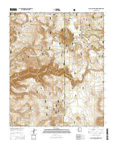
~ Apache Maid Mountain AZ topo map, 1:24000 scale, 7.5 X 7.5 Minute, 2014
Apache Maid Mountain, Arizona, USGS topographic map dated 2014.
Includes geographic coordinates (latitude and longitude). This topographic map is suitable for hiking, camping, and exploring, or framing it as a wall map.
Printed on-demand using high resolution imagery, on heavy weight and acid free paper, or alternatively on a variety of synthetic materials.
Topos available on paper, Waterproof, Poly, or Tyvek. Usually shipping rolled, unless combined with other folded maps in one order.
- Product Number: USGS-7235306
- Free digital map download (high-resolution, GeoPDF): Apache Maid Mountain, Arizona (file size: 26 MB)
- Map Size: please refer to the dimensions of the GeoPDF map above
- Weight (paper map): ca. 55 grams
- Map Type: POD USGS Topographic Map
- Map Series: US Topo
- Map Verison: Current
- Cell ID: 1242
- Datum: North American Datum of 1983
- Map Projection: Transverse Mercator
- Map Cell Name: Apache Maid Mountain
- Grid size: 7.5 X 7.5 Minute
- Date on map: 2014
- Map Scale: 1:24000
- Geographical region: Arizona, United States
Neighboring Maps:
All neighboring USGS topo maps are available for sale online at a variety of scales.
Spatial coverage:
Topo map Apache Maid Mountain, Arizona, covers the geographical area associated the following places:
- Fivemile Pass Tank Number Two - Mullican Tank Number One - Harris Tank - New Tank - Sues Tank - T-Bar Tank - Horse Knoll - Cuter Place Tank - Burnt Basin Tank - North Rim Tank - Rocky Gulch - Cuter Tank - Road Tank - Apache Maid Ranger Station - Knob Tank - Round Mountain Tank - Sues Tank - Brady Tank - Mullican Place Tank - Cove Tank - Wier Number Five - Weir Number Eleven - Little Hog Hill Tank - Anniversary Tank - Wet Beaver Wilderness - T-Bar Ranch - Table Mountain Tank - Apache Maid Cabin - Cuter Tank - Oak Hill - Utopia Tank - Mullican Ranch - Wier Number Six - T-bar Tank Number Two - Campbell Draw Tank - Fivemile Pass Tank - Big Hill Tank - Roundup Basin Tank - Waldroup Tank - Table Mountain Tank - Waldroup Place Tank - Slope Tank - Roundup Basin - Tin Roof Tank - Mullican Tank - Fivemile Pass Tank Number One - Jacks Canyon - Brady Canyon - Horse Knoll Tank - Fritz Tank - Three Wall Tank - Rim Tank - Table Mountain - V D Tank - Hog Hill - Apache Maid Mountain - Lookout Point Tank - Division Tank - Apache Maid Trail - Big Hill - Trail Tank - Pine Ridge Tank - T-bar Tank Number One - Maid Tank - Fivemile Pass - Four Wall Tank - Bruce Place Tank - Tinny Tank
- Map Area ID: AREA34.7534.625-111.625-111.5
- Northwest corner Lat/Long code: USGSNW34.75-111.625
- Northeast corner Lat/Long code: USGSNE34.75-111.5
- Southwest corner Lat/Long code: USGSSW34.625-111.625
- Southeast corner Lat/Long code: USGSSE34.625-111.5
- Northern map edge Latitude: 34.75
- Southern map edge Latitude: 34.625
- Western map edge Longitude: -111.625
- Eastern map edge Longitude: -111.5


